Volcanic unrest persisted across the globe during the past 24 hours, with monitoring agencies recording 28 distinct eruptive events according to the Smithsonian Global Volcanism Program. The period was dominated by significant ash emissions from four major stratovolcanoes along the Pacific Ring of Fire, prompting aviation advisories and heightened monitoring by local observatories. Ash plumes from Sabancaya in Peru, Shiveluch in Russia, Sangay in Ecuador, and Popocatépetl in Mexico reached elevations between 6,100 and 7,000 meters, creating potential hazards for transcontinental flight corridors.
Which Volcanoes Generated Ash Advisories Today?
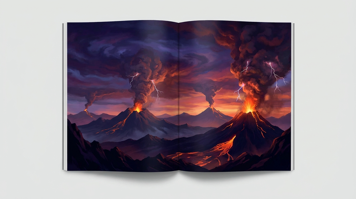
Sabancaya (Peru) produced the highest ash plume detected in the reporting period, with emissions reaching 7,000 meters (23,000 feet) above sea level according to data published by the Smithsonian Global Volcanism Program. The Volcanic Ash Advisory Center (VAAC) Buenos Aires issued advisories for this persistent activity, which represents ongoing explosive behavior characteristic of this andesitic stratovolcano. Sabancaya has maintained elevated unrest since 2016, with frequent vulcanian eruptions generating ash columns that affect the surrounding Arequipa region.
Shiveluch (Kamchatka Peninsula, Russia) generated an ash advisory with plumes reaching 6,700 meters (22,000 feet) reported by the Tokyo VAAC. This lava dome-forming volcano remains one of the most active in the Kuril-Kamchatka arc, characterized by periodic dome collapses and ash explosions. The current activity follows the major sector collapse event of April 2023, with the volcano continuing to extrude viscous dacitic lava that fuels explosive interactions with the hydrothermal system.
Sangay (Ecuador) produced ash emissions reaching 6,400 meters (21,000 feet) according to the Washington VAAC. Located in the remote Cordillera Real of the Ecuadorian Andes, Sangay is one of the world’s most persistently active volcanoes, maintaining near-continuous strombolian activity since 2016. Today’s ash advisory reflects intermittent explosions from the summit crater that occasionally loft material into aviation altitudes, particularly during periods of heightened magma discharge.
Popocatépetl (Mexico) registered ash plumes reaching 6,100 meters (20,000 feet) above mean sea level reported by the Mexico City Volcanic Ash Advisory Center. Located just 70 kilometers southeast of Mexico City, this stratovolcano remains under elevated alert status due to frequent vulcanian explosions and dome growth within its summit crater. The ash emissions pose recurring hazards to the Puebla-Tlaxcala metropolitan area and major aviation routes connecting North and South America.
How Dangerous Are the Ash Emissions?
Volcanic ash clouds present critical hazards to jet aircraft engines, with particles melting and fusing to turbine blades when ingested at high temperatures. The reported plume altitudes of 6,100 to 7,000 meters correspond to typical cruising flight levels for commercial aviation, specifically Flight Level 200 through Flight Level 230. Ash composition analysis from these volcanoes indicates intermediate to silicic magma types, producing fine-grained particulate matter that can remain suspended in the atmosphere for extended periods, disrupting regional air traffic patterns across South America, North America, and the western Pacific.
Ground-based ashfall from these events poses additional respiratory hazards for proximal populations, particularly affecting communities within 20 kilometers of the source vents. Popocatépetl’s proximity to Mexico City requires constant monitoring of ash dispersal patterns, while Sangay’s remote location minimizes direct human impact despite significant aviation concerns. The sulfur dioxide emissions accompanying these ash clouds may contribute to localized acid rain events and transient climate cooling effects if injected into the stratosphere.
What Other Volcanic Systems Are Currently Active?
Beyond the major ash-producing events, seventeen additional volcanic systems exhibited detectable unrest or eruptive activity during the reporting period. Fuego (Guatemala) continued its characteristic strombolian activity with lava flows reported by the Instituto Nacional de Sismología, Vulcanología, Meteorología e Hidrología (INSIVUMEH). Lewotobi (Indonesia) maintained elevated seismicity and thermal anomalies according to MAGMA Indonesia monitoring networks.
Reventador (Ecuador) produced explosive activity affecting the Amazonian foothills, while Mayon and Taal (Philippines) remained under elevated alert levels monitored by the Philippine Institute of Volcanology and Seismology (PHIVOLCS). Semeru, Ibu, and Dukono (Indonesia) generated continuous ash emissions typical of their open-vent eruptive styles. Canlaon (Philippines) and Puracé (Colombia) showed elevated seismic swarm activity without major eruptive episodes.
Aoba (Vanuatu) exhibited thermal anomalies consistent with active lava lake behavior, while Central Bismarck Sea (Papua New Guinea) showed submarine volcanic indicators including discolored water and acoustic T-waves detected by hydrophone arrays. These diverse eruptive styles demonstrate the continuous recycling of Earth’s lithosphere along convergent plate boundaries and hotspot systems.
What Should Aviation Operators Know?
The Volcanic Ash Advisory Centers (VAAC) in Washington, Buenos Aires, Tokyo, and Mexico City have established temporary flight restrictions and rerouting recommendations for airspace surrounding the active volcanoes. Pilots should consult current SIGMETs (Significant Meteorological Information) for coordinates of ash cloud dispersal, noting that volcanic ash can drift hundreds of kilometers downwind from source vents. The International Civil Aviation Organization (ICAO) recommends minimum horizontal separation of 100 nautical miles from identified ash clouds, though visual detection remains challenging particularly during nighttime operations or instrument meteorological conditions.
Aircraft encountering unexpected ash should reduce thrust to idle, exit the cloud immediately by reversing course or descending, and perform post-flight engine and airframe inspections. Continuous monitoring of Multi-functional Transport Satellite (MTSAT) and Geostationary Operational Environmental Satellite (GOES) imagery provides real-time tracking of ash cloud evolution, supplemented by ground-based infrasound arrays and lightning detection networks that identify explosive eruption onsets.
| Volcano | Location | Event Type | Alert Level |
|---|---|---|---|
| Sabancaya | Peru | Ash Advisory | Orange |
| Shiveluch | Russia | Ash Advisory | Not Specified |
| Sangay | Ecuador | Ash Advisory | Not Specified |
| Popocatépetl | Mexico | Ash Advisory | Not Specified |
| Fuego | Guatemala | Eruption | Orange |
| Lewotobi | Indonesia | Eruption | Level III (Siaga) |
| Reventador | Ecuador | Eruption | Orange |
| Semeru | Indonesia | Eruption | Level III (Siaga) |
| Ibu | Indonesia | Eruption | Level III (Siaga) |
| Sangay | Ecuador | Ash Advisory | Not Specified |
| Mayon | Philippines | Lava Dome Growth | Alert Level 2 |
| Puracé | Colombia | Seismic Swarm | Yellow |
| Taal | Philippines | Volcanic Earthquakes | Alert Level 1 |
| Aoba | Vanuatu | Thermal Anomaly | Alert Level 2 |
| Dukono | Indonesia | Continuous Ash | Level II (Waspada) |
| Canlaon | Philippines | Volcanic Tremor | Alert Level 1 |
| Central Bismarck Sea | Papua New Guinea | Submarine Activity | Unassigned |
Alert levels reflect status reported by local monitoring agencies including IG Peru, KVERT, IG Ecuador, CENAPRED, PHIVOLCS, MAGMA Indonesia, and SERNAGEOMIN.
Frequently Asked Questions
What causes volcanoes to produce different ash column heights?
Ash column height primarily depends on eruption intensity, which correlates with magma gas content, viscosity, and vent geometry. Explosive interactions between rising magma and groundwater or surface water (phreatomagmatic eruptions) typically generate higher ash columns than dry magmatic explosions. Wind speed and atmospheric stability also affect observed plume altitude, with strong wind shear sometimes limiting vertical development despite energetic eruptions.
How long do volcanic ash clouds remain dangerous for aircraft?
Volcanic ash clouds can remain hazardous for aviation for hours to weeks depending on eruption duration, ash volume, and atmospheric conditions. Fine ash particles (less than 2 millimeters diameter) may remain suspended in the atmosphere for days, drifting thousands of kilometers from the source. Pilots should never assume that ash clouds have dissipated simply because they are no longer visible, as ash concentrations below visual detection thresholds can still cause engine damage.
Why are there so many active volcanoes along the Pacific Ring of Fire?
The Pacific Ring of Fire hosts approximately 75% of the world’s active volcanoes due to the process of subduction, where denser oceanic tectonic plates dive beneath continental plates. This process generates magma through flux melting of the mantle wedge, creating explosive andesitic to dacitic volcanism characteristic of the region. The Ring of Fire represents the boundaries of the Pacific Plate interacting with surrounding continental plates, making it the most seismically and volcanically active zone on Earth.
Track this event live on the map!
Download GeoShake and get instant earthquake alerts.
Download GeoShake