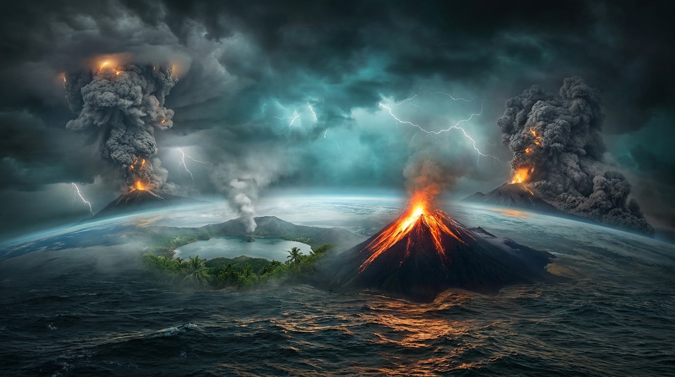
Global volcanic monitoring networks recorded 44 distinct volcanic events across 26 active systems during the past 24 hours, according to the Smithsonian Global Volcanism Program. Notable eruptive activity intensified along the Pacific Ring of Fire, with significant ash-producing events detected at Great Sitkin in the Aleutian Islands, Fuego in Guatemala, and Taal in the Philippines. Additional volcanic unrest was confirmed at Sangay in Ecuador and Poás in Costa Rica, prompting heightened scrutiny from international aviation authorities and local emergency management agencies.
Which Volcanoes Erupted Today?
Great Sitkin (Aleutian Islands, Alaska, USA) continues its prolonged eruptive sequence characterized by lava dome growth and intermittent explosive activity within the summit crater. The volcano, which resumed significant activity in 2021, produced detectable thermal anomalies and minor ash emissions throughout the reporting period, though specific plume heights remained below aviation threat thresholds according to the Alaska Volcano Observatory.
Fuego (Guatemala) generated Strombolian explosions with incandescent material ejected several hundred meters above the crater rim. The Instituto Nacional de Sismología, Vulcanología, Meteorología e Hidrología (INSIVUMEH) maintains an Advisory alert level for the volcano, indicating ongoing magmatic activity with ash plumes drifting southwest toward populated areas. Lahars remain a significant concern during the current rainy season as loose volcanic debris mixes with precipitation.
Taal (Luzon, Philippines) exhibited phreatomagmatic activity driven by the interaction of magma with the crater lake’s hydrothermal system. The Philippine Institute of Volcanology and Seismology (PHIVOLCS) continues monitoring elevated sulfur dioxide flux and volcanic earthquake swarms, restricting access to the Permanent Danger Zone due to the potential for base surges and ballistic projectiles.
Sangay (Morona-Santiago, Ecuador) produced ash columns visible in satellite imagery extending eastward over the Amazon basin. The Instituto Geofísico de la Escuela Politécnica Nacional (IGEPN) reported frequent explosive signals indicating sustained dome extrusion within the summit crater, generating pyroclastic density currents down the southeast flank.
Poás (Alajuela Province, Costa Rica) experienced phreatic eruptions driven by superheated groundwater interacting with the crater lake. The Observatorio Vulcanológico y Sismológico de Costa Rica (OVSICORI) documented geyser-like activity ejecting sediment and sulfur-rich steam, temporarily increasing acidity levels in the summit lake while producing localized ash fall within the national park boundaries.
How Dangerous Are the Ash Emissions?
Volcanic ash generated during these eruptions poses multifaceted hazards depending on particle size, composition, and atmospheric dispersion patterns. Silica-rich ash from explosive events like those at Fuego and Sangay can cause respiratory distress in vulnerable populations within 20 kilometers of the vent, while abrasive particles threaten agricultural infrastructure and water catchment systems.
The absence of specified ash column heights in the latest reports suggests either low-altitude emissions below 3,000 meters or obscured observations due to meteorological cloud cover. However, even minor volcanic clouds can disrupt local aviation operations and contaminate surface water supplies. Communities downwind should utilize N95 respirators during ashfall events and avoid driving to prevent vehicle engine damage from fine particulate matter.
What Should Aviation Know?
Pilots and flight dispatchers must consult Volcanic Ash Advisory Centers (VAACs) for real-time trajectory modeling of eruption columns. Great Sitkin falls under the jurisdiction of the Anchorage VAAC, while Fuego and Sangay are monitored by the Washington VAAC. Taal and other Philippine volcanoes are covered by the Tokyo VAAC, and Indonesian systems including Ibu, Semeru, and Lewotobi are tracked by the Darwin VAAC.
Volcanic ash advisory levels range from Green (dormant) to Red (major eruption imminent). While only Fuego currently carries an explicit Advisory designation, the concentration of eruptive activity across the Pacific Rim necessitates enhanced pre-flight briefings. Jet aircraft encountering ash clouds face severe turbine damage, flameout conditions, and cockpit window abrasion, requiring immediate altitude changes of at least 1,000 feet to exit visible or detected ash layers.
Are Evacuation Orders Currently in Effect?
The Advisory alert level for Fuego indicates heightened unrest without immediate requirement for mass civilian evacuation, though communities within the 15-kilometer exclusion zone maintain readiness for rapid displacement. Guatemalan disaster response agencies have pre-positioned emergency supplies in Escuintla and Sacatepéquez departments based on pyroclastic flow modeling.
In the Philippines, Taal maintains permanent settlement restrictions within the 7-kilometer danger zone, with approximately 12,000 residents living in high-risk barangays around Volcano Island. Indonesian authorities monitor Ibu, Dempo, and Gamalama for potential escalation, while Alaskan officials confirm no population centers lie within the hazard footprint of Great Sitkin or Kupreanof, minimizing immediate civil protection concerns despite continued lava dome inflation.
Active Volcano Summary Table
| Volcano | Location | Event Type | Alert Level |
|---|---|---|---|
| Great Sitkin | Aleutian Islands, USA | Lava Dome Eruption | Advisory |
| Fuego | Guatemala | Strombolian Eruption | Advisory |
| Taal | Luzon, Philippines | Phreatomagmatic Activity | Not Specified |
| Sangay | Ecuador | Ash Eruption | Not Specified |
| Poás | Costa Rica | Phreatic Eruption | Not Specified |
| Shiveluch | Kamchatka, Russia | Dome Growth | Not Specified |
| Ibu | Halmahera, Indonesia | Strombolian Activity | Not Specified |
| Central Bismarck Sea | Papua New Guinea | Submarine Activity | Not Specified |
| Lewotobi | Flores, Indonesia | Eruption | Not Specified |
| Kanlaon | Negros, Philippines | Unrest | Not Specified |
| Dukono | Halmahera, Indonesia | Continuous Ash | Not Specified |
| Sabancaya | Peru | Explosive Activity | Not Specified |
| Puracé | Colombia | Degassing | Not Specified |
| Mayon | Luzon, Philippines | Dome Growth | Not Specified |
| Reventador | Ecuador | Explosive Eruption | Not Specified |
| Semeru | Java, Indonesia | Ash Eruption | Not Specified |
| Iya | Flores, Indonesia | Unrest | Not Specified |
| Karangetang | Siau, Indonesia | Lava Flows | Not Specified |
| Kupreanof | Alaska, USA | Seismic Swarm | Not Specified |
| Dempo | Sumatra, Indonesia | Minor Explosions | Not Specified |
| Gamalama | Ternate, Indonesia | Eruption | Not Specified |
| Bulusan | Luzon, Philippines | Phreatic Bursts | Not Specified |
| Bur ni Telong | Sumatra, Indonesia | Increased Seismicity | Not Specified |
| Popocatépetl | Mexico | Strombolian Activity | Not Specified |
| Lewotolok | Lembata, Indonesia | Ash Emissions | Not Specified |
| Kīlauea | Hawaii, USA | Summit Inflation | Not Specified |
Frequently Asked Questions
What does an Advisory alert level indicate?
An Advisory status signifies that volcanic activity has elevated above background levels but does not pose an immediate threat to populated areas. This designation warns of potential ash emissions affecting aviation operations and signals the possibility of escalation to Watch or Warning status if explosive intensity increases or monitoring parameters deteriorate rapidly.
How far can volcanic ash travel from these eruption sites?
Volcanic ash can traverse thousands of kilometers depending on eruption column height and prevailing wind patterns. High-altitude jet streams may transport fine ash particles from Alaskan eruptions across North America within 24 to 48 hours, while tropical eruptions in Indonesia or the Philippines can affect intercontinental flight corridors between Asia and Australia for weeks following major explosive events.
Why are numerous volcanoes active simultaneously along the Ring of Fire?
The Ring of Fire represents a continuous belt of subduction zones where approximately 75 percent of the world’s active volcanoes reside. Simultaneous activity reflects independent magmatic systems responding to localized tectonic stresses rather than a single connected geological cause, though regional seismic swarms can occasionally trigger multiple volcanic systems within condensed timeframes due to stress transfer across adjacent crustal blocks.
Track this event live on the map!
Download GeoShake and get instant earthquake alerts.
Download GeoShake