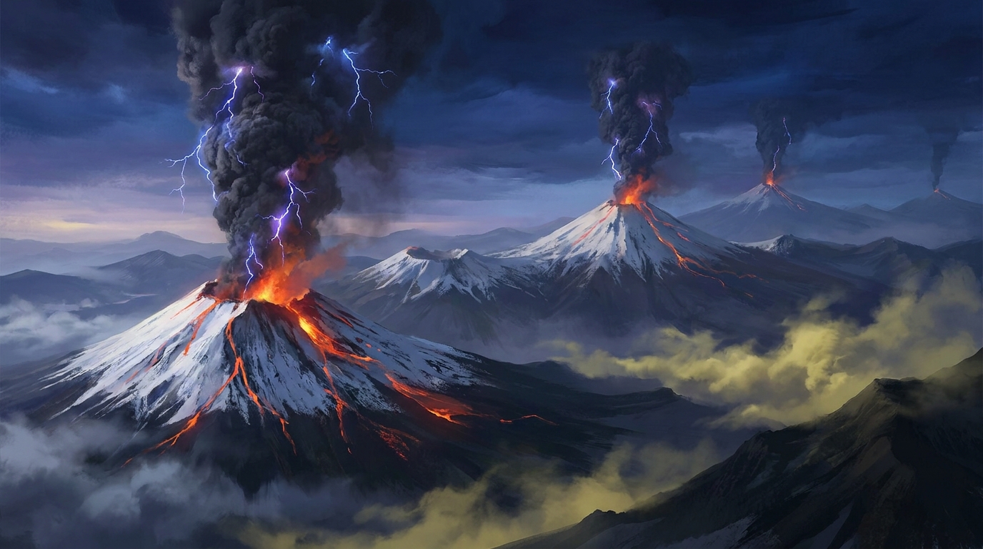
Global volcanic monitoring networks detected 37 distinct eruptive events during the past 24 hours, according to the Smithsonian Global Volcanism Program. Notable activity includes explosive episodes at Ecuador’s Sangay, Guatemala’s Fuego, and Mexico’s Popocatépetl, alongside simultaneous unrest across Indonesia’s eastern archipelago. Local observatories and Volcanic Ash Advisory Centers (VAACs) continue to track plume trajectories and ashfall hazards as these systems maintain elevated output levels.
Which Volcanoes Showed the Most Significant Activity Today?
Sangay in Ecuador generated sustained eruptive pulses detected by seismic networks early Thursday morning. Located within the Cordillera Real approximately 40 kilometers from Riobamba, this stratovolcano produced ash emissions that dispersed toward the east, according to reports compiled by the Smithsonian GVP. The volcano maintains one of the highest activity levels in the Andes, with frequent explosions occurring from its central vent and southeastern flank dome.
Fuego (Guatemala) entered an eruptive phase characterized by explosive ejecta and potential lava flow generation. Situated roughly 40 kilometers southwest of Guatemala City, Fuego’s steep cone regularly produces ash plumes that impact the surrounding Sacatepéquez, Escuintla, and Chimaltenango departments. Local monitoring agencies reported incandescent material being ejected above the crater rim during the early morning hours.
Popocatépetl in Mexico registered explosive activity detected by CENAPRED (National Center for Prevention of Disasters) sensors. Located just 70 kilometers southeast of Mexico City, this 5,426-meter stratovolcano continues its prolonged period of unrest with discrete explosions and passive ash venting. Prevailing wind patterns carried fine volcanic ash toward the eastern sectors of Puebla state.
Ibu (Indonesia) sustained its ongoing eruptive sequence from the northwestern coast of Halmahera Island. PVMBG (Indonesian Center for Volcanology and Geological Hazard Mitigation) observation posts noted ash column production and minor explosive events typical of the volcano’s recent high-tempo activity. The remote island location complicates ground-based monitoring, requiring heavy reliance on satellite thermal sensors.
Lewotolok (Indonesia) exhibited explosive behavior from its position on Lembata Island in the East Nusa Tenggara province. According to regional monitoring networks, the volcano produced ash plumes and seismic tremor signals consistent with magma ascent. This adds to the cluster of simultaneous Indonesian eruptions detected during the reporting period.
How Dangerous Are the Ash Emissions for Local Populations?
Volcanic ash generated by today’s eruptions poses respiratory hazards and infrastructure risks for communities downwind of active vents. Fine silicate particles less than two millimeters in diameter can penetrate deep into lung tissue, causing bronchial irritation and exacerbating asthma conditions, according to USGS health hazard assessments. Ashfall accumulation on rooftops creates structural loading dangers, while contaminated water supplies and damaged agricultural crops represent secondary economic impacts.
Popocatépetl’s proximity to major population centers including Puebla (1.5 million residents) and Mexico City (21 million metropolitan population) elevates the risk profile for urban ashfall impacts. Prevailing easterly winds during the current meteorological pattern direct emissions toward densely populated highland communities rather than the capital itself. Residents should implement N95 mask protocols and avoid outdoor exposure during peak ashfall events.
What Should Aviation Operators Know About Current Conditions?
Pilots and dispatchers must consult the latest Volcanic Ash Advisory Center (VAAC) warnings before routing through Central American, Andean, or Indonesian airspace. Volcanic ash clouds drift at altitudes between 20,000 and 40,000 feet, precisely where commercial jet aircraft operate, creating engine flameout risks and abrasion damage to windshields and airframes. The Washington VAAC monitors Popocatépetl and Fuego activity, while the Darwin VAAC tracks Indonesian systems including Ibu and Lewotolok.
Aircraft encountering ash may experience acrid odors in the cabin, St. Elmo’s fire on the windshield, and multiple engine surges. Immediate exit strategies require 180-degree turns rather than vertical escape maneuvers, as ash clouds often extend thousands of feet vertically. Airports in Guatemala City, Quito, and Mexico City maintain ash contingency protocols, though no flight cancellations were reported at press time.
Is the Ring of Fire Experiencing Unusual Clustering?
Indonesia’s current multi-volcano activation reflects the complex tectonics of the Pacific Ring of Fire rather than an anomalous geologic event. Simultaneous eruptions at Ibu, Lewotolok, Semeru, and Gamalama demonstrate the archipelago’s position above the convergent boundary between the Indo-Australian and Eurasian plates. According to the Smithsonian GVP, such clustering occurs frequently as regional stress fields adjust, triggering magma movement in adjacent volcanic systems.
The eastern Indonesian sector currently shows the highest concentration of activity, with Ibu and Lewotolok separated by approximately 600 kilometers but both responding to subduction-related magma generation. Ground deformation monitoring and gas emission measurements suggest these systems operate independently rather than representing a single magmatic trigger. PVMBG maintains Level II (Alert) or Level III (Standby) status for most of these systems, restricting access to summit craters.
Active Volcano Summary Table
| Volcano | Location | Event Type | Alert Level |
|---|---|---|---|
| Sangay | Ecuador | Eruption | Not Specified |
| Fuego | Guatemala | Eruption | Not Specified |
| Popocatépetl | Mexico | Eruption | Not Specified |
| Ibu | Indonesia | Eruption | Not Specified |
| Lewotolok | Indonesia | Eruption | Not Specified |
| Reventador | Ecuador | Eruption | Not Specified |
| Santa María | Guatemala | Dome Activity | Not Specified |
| Santiaguito | Guatemala | Dome Activity | Not Specified |
| Pacaya | Guatemala | Strombolian | Not Specified |
| Semeru | Indonesia | Eruption | Not Specified |
| Gamalama | Indonesia | Eruption | Not Specified |
| Puracé | Colombia | Unrest | Not Specified |
| Stromboli | Italy | Strombolian | Not Specified |
| Sabancaya | Peru | Explosion | Not Specified |
| Canlaon | Philippines | Unrest | Not Specified |
| Mayon | Philippines | Unrest | Not Specified |
| Sakurajima | Japan | Explosion | Not Specified |
Frequently Asked Questions
How does volcanic ash affect aircraft engines?
Volcanic ash consists of tiny silicate glass particles that melt when ingested by jet engines operating at high temperatures, coating turbine blades and blocking fuel nozzles. This process can cause engine surge, flameout, and permanent damage requiring complete engine replacement. Pilots rely on VAAC advisories and satellite monitoring to navigate around invisible ash clouds that weather radar cannot detect.
What distinguishes an explosive eruption from continuous lava effusion?
Explosive eruptions result from gas-rich magma fragmenting into ash and pumice during rapid decompression, creating eruption columns that reach the stratosphere. Effusive eruptions release degassed magma as lava flows with minimal explosive component. Today’s reported events at Sangay and Fuego involved explosive mechanisms capable of distributing ash regionally, rather than localized lava dome growth.
Why do Indonesian volcanoes erupt simultaneously so frequently?
Indonesia hosts over 130 active volcanoes positioned along the subduction zones of the Pacific Ring of Fire, where tectonic plate collisions generate massive volumes of magma. While individual volcanoes possess distinct magma chambers, regional tectonic adjustments can trigger unrest across multiple systems within short timeframes. The Indonesian Center for Volcanology and Geological Hazard Mitigation (PVMBG) maintains continuous monitoring of these systems through seismic networks and ground deformation stations.
Track this event live on the map!
Download GeoShake and get instant earthquake alerts.
Download GeoShake