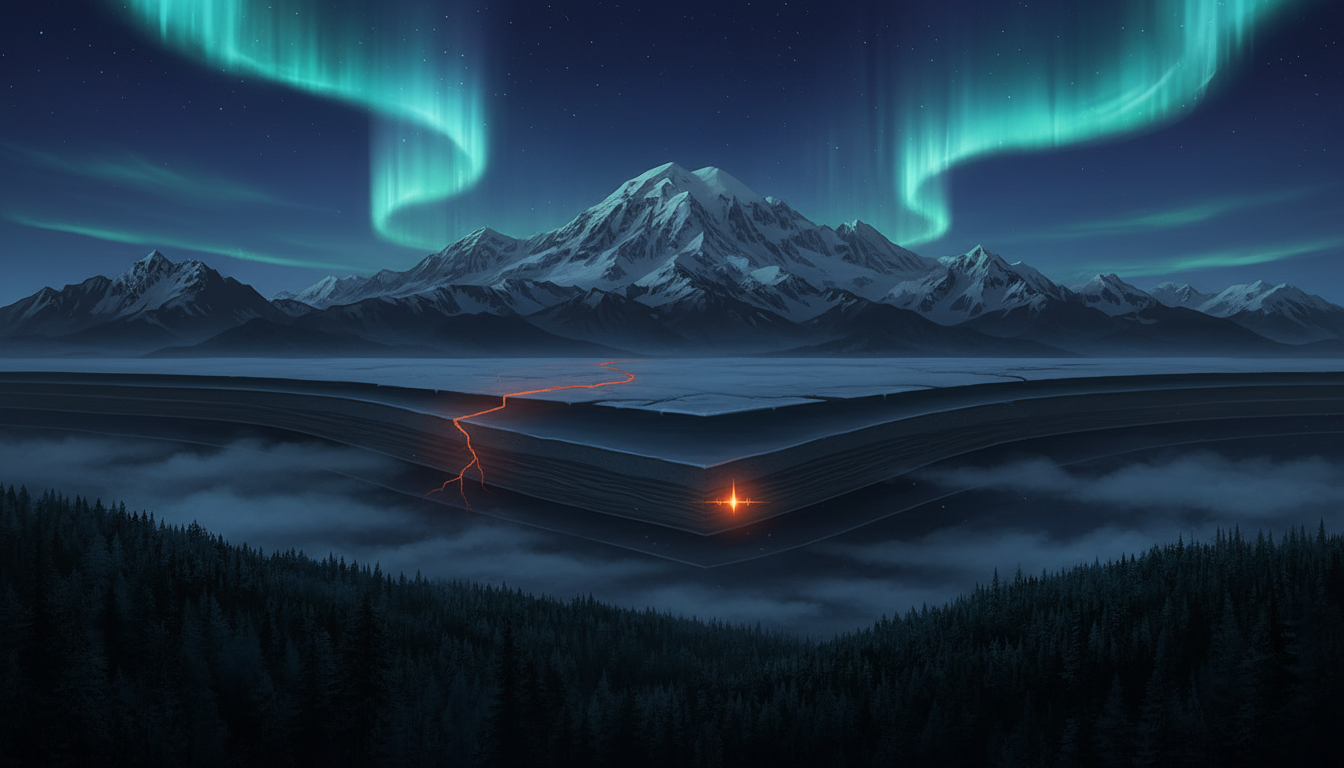
Lead
Seventy-three kilometres southeast of where the Denali Fault tore through the Alaskan wilderness in 2002—unleashing one of the largest strike-slip earthquakes ever recorded in North America—the ground stirred once more. On the morning of March 21, a magnitude 2.1 tremor pulsed through the rock at a depth of 80.6 kilometres, roughly 22 kilometres southeast of Cantwell. Imperceptible to residents and wildlife alike, the quake registered only as a faint scribble on seismographic drums, yet it arrived at a location of profound geological significance: within the broad zone still adjusting to the cataclysmic M7.9 rupture that redefined our understanding of continental deformation over two decades ago.
Context
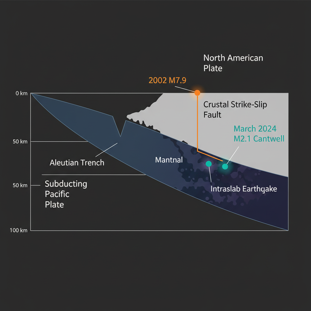
The Denali Fault represents a critical suture in Alaska’s tectonic fabric, a right-lateral strike-slip boundary where the crustal blocks of southern Alaska grind past interior North America at approximately one centimetre per year—roughly the rate at which human fingernails grow. In November 2002, this geological seam failed spectacularly, producing a shallow magnitude 7.9 earthquake that ripped 340 kilometres of surface and propagated eastward with devastating efficiency. The recent Cantwell tremor sits squarely within this fault system’s sphere of influence, located just 73 kilometres from the 2002 rupture zone and a mere 54 kilometres from the epicentre of a significant M6.6 aftershock that followed the main event.
Seismologists classify this latest event as an intermediate-depth earthquake, occurring well below the shallow crust where the Denali Fault’s surface trace dominates. At 80.6 kilometres down, the tremor likely nucleated within the subducting Pacific Plate—the oceanic slab that dives beneath southern Alaska at the Aleutian Trench and fuels the region’s volcanic arc. Here, within the descending lithosphere, rock temperatures and pressures are high enough to allow sudden, brittle failure despite the depth, generating intraslab earthquakes that send energy bleeding upward through the overlying continental crust. This vertical positioning makes the event scientifically valuable; it offers a glimpse of how stress channels from the deep subduction system interact with the shallow transform faults slicing through the crust above.
Impact Analysis
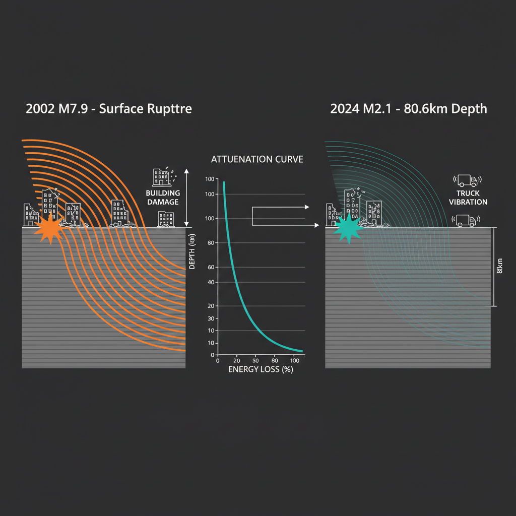
For the sparse population near Cantwell, the March 21 tremor passed entirely unnoticed. A magnitude 2.1 event releases roughly the energy of a large quarry blast, but when buried beneath 80 kilometres of rock, that energy attenuates significantly before reaching the boreal forest floor. Seismologists estimate that ground motion likely never exceeded instrumental detection levels—comparable to the faint vibration of a heavy truck passing several kilometres distant, perceptible only to sensitive accelerometers.
This seismic silence contrasts sharply with the region’s recent restlessness. Over the past seven days alone, instruments have recorded 30 earthquakes within a 200-kilometre radius, including a magnitude 5.1 event near the Kuril Islands and several smaller crustal adjustments closer to home. Yet the Cantwell event distinguishes itself through its depth and tectonic context. While shallow earthquakes along the Denali Fault system—like the devastating 2002 mainshock or the 2021 M6.1 event near Chickaloon—pose the greatest immediate surface hazard, these deeper intraslab events help seismologists map the three-dimensional stress field that drives regional seismicity. The 1991 M6.3 Central Alaska earthquake demonstrated that significant energy release can occur throughout this crustal column, suggesting a complex interplay between deep slab mechanics and shallow fault friction.
Closing
As Alaska’s network of broadband seismometers continues to capture these subtle vibrations, each data point refines our understanding of how the 2002 rupture zone continues to evolve. While a magnitude 2.1 event poses no hazard to infrastructure or communities, it contributes to a longitudinal dataset tracking whether the Denali Fault is gradually reloading its elastic strain—preparing for future movements—or releasing residual stresses from past upheavals. GeoShake monitoring indicates that central Alaska maintains its characteristic seismic restlessness, a reminder that beneath the frozen tundra and snow-capped peaks, the continent continues its slow, relentless deformation. In the quiet between major ruptures, it is these barely perceptible tremors from the depths that keep the scientific watch.
Track this event live on the map!
Download GeoShake and get instant earthquake alerts.
Download GeoShake