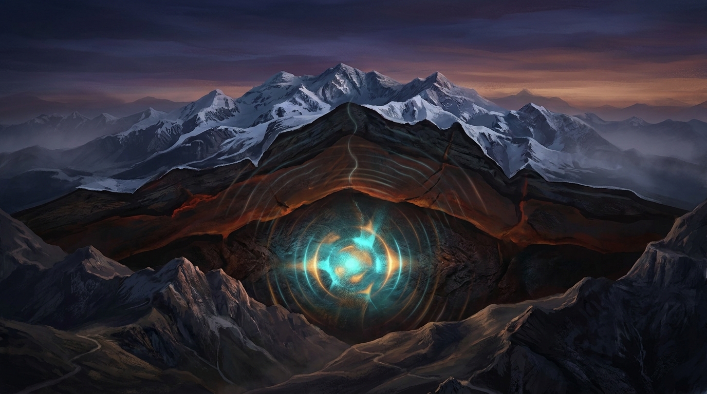
At 2:54 AM local time on April 18, 2026, the ground beneath Afghanistan’s Hindu Kush mountains shuddered with a peculiar, rolling energy. The earthquake originated nearly 200 kilometers below the surface—so deep that the rocky village of Jurm, located 27 kilometers north of the epicenter, likely experienced the tremor as a prolonged sway rather than a sharp jolt, according to USGS data. This was no shallow crustal rupture; it was a window into the slow, violent collision of continental plates happening deep within the planet’s upper mantle.
Why Is This Region So Prone to Deep Earthquakes?
The Hindu Kush region sits at the crumpled collision zone between the Indian and Eurasian tectonic plates, a boundary that has been constructing the world’s highest mountain ranges for roughly 50 million years. Unlike the dramatic oceanic subduction zones that generate tsunamis along coastal trenches, this continental collision forces dense slices of the Indian plate to detach and sink—delaminate—into the hot, ductile upper mantle beneath Afghanistan.
Seismologists classify earthquakes at this depth—198.8 kilometers—as intermediate-depth events, occurring within the descending lithospheric slab rather than the shallow crust. As the cold, brittle plate material descends, it warps and fractures under immense temperature and pressure differentials, generating earthquakes that radiate energy efficiently through the surrounding hot mantle. This process creates the Hindu Kush seismic zone, one of the most active deep-earthquake regions on Earth, producing roughly one magnitude 7 event every decade or so. The mechanics here are distinct from California’s strike-slip faults or Japan’s oceanic subduction; when continents collide, the crust thickens into the Tibetan Plateau, but pieces of the lower plate break off and plummet into the mantle like geologic anchors, creating a unique intracontinental subduction system.
What Does 200 Kilometers of Depth Mean for Surface Shaking?
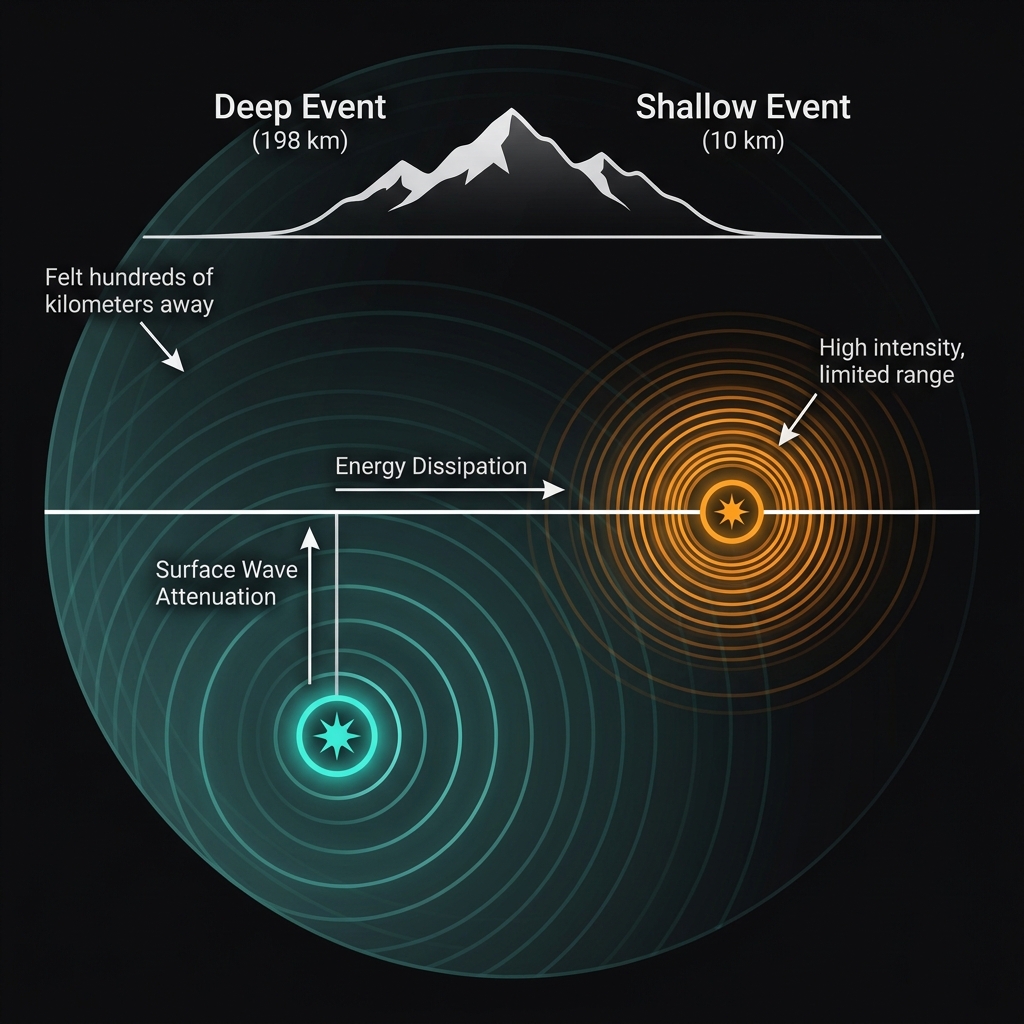
Depth acts as nature’s shock absorber. When an earthquake strikes at 198 kilometers, the seismic waves must travel nearly 125 miles upward before reaching villages and valleys, dissipating energy and spreading outward as they go. A magnitude 5.3 event at this depth typically produces light to moderate shaking at the surface—comparable to the rumble of a passing heavy truck—rather than the violent ground acceleration that a shallow M5.3 might cause directly above the rupture.
However, depth also expands the reach significantly. While a shallow earthquake might be felt only 50 kilometers away, this deep event likely sent perceptible vibrations across hundreds of kilometers, potentially reaching Kabul to the south and Dushanbe to the north. The shaking characteristics differ too: deep earthquakes generate lower-frequency waves that travel great distances through the Earth’s mantle but cause less damage to rigid structures than the high-frequency jolts of shallow quakes.
| Event | Magnitude | Depth | Distance from Jurm | Year |
|---|---|---|---|---|
| April 18, 2026 | 5.3 | 198.8 km | 27 km | 2026 |
| Hindu Kush | 7.5 | ~210 km* | 39 km | 2015 |
| SW of Jurm | 7.4 | ~220 km* | 30 km | 2002 |
| SSE of Jurm | 6.5 | ~200 km* | 18 km | 2023 |
*Typical depths for Hindu Kush events; exact values vary by source.
This event fits a sobering historical pattern. The region has hosted ten magnitude 6 or greater earthquakes within 100 kilometers of Jurm since 1991, including the devastating M7.5 in 2015 that killed hundreds across Afghanistan and Pakistan. Seismologists classify these as part of the same deep seismogenic zone, where the cold slab meets the hot mantle—a transition that generates some of the most physically intriguing earthquakes on the planet. Unlike the 2015 shallower event, today’s M5.3 represents the more frequent, deeper seismicity that constantly reshapes the region from below, part of a cluster of three earthquakes recorded in the area over the past week alone.
What Should We Watch For Now?
Deep earthquakes like this one rarely trigger tsunamis—the USGS tsunami warning system correctly assessed zero risk within minutes—and typically produce limited aftershock sequences compared to shallow crustal events. However, the event serves as a reminder that stress is constantly reloading in the Hindu Kush. Seismologists note that intermediate-depth earthquakes here often exhibit fewer aftershocks, though the recent clustering suggests ongoing adjustment within the descending slab.
GeoShake monitoring systems will track this region for any shallow triggered events in the crust above the rupture zone, though such cascading failures are rare. For the resilient communities of Badakhshan Province, this tremor was another pulse in the geologic heartbeat of Central Asia, neither the first nor the last in a region where the ground has been moving for millions of years.
Frequently Asked Questions
How strong was this earthquake?
The earthquake registered as magnitude 5.3 on the moment magnitude scale, a moderate event that typically causes light shaking at the surface when occurring at shallow depths. However, because this quake originated nearly 200 kilometers below ground, the intensity felt on the surface was likely reduced to levels perceptible only to those at rest or in upper floors of buildings, with minimal potential for structural damage.
Is there a tsunami risk from earthquakes in Afghanistan?
No. The USGS confirmed no tsunami threat from this event. Landlocked Afghanistan lacks oceanic coastlines, and even deep earthquakes in this region do not displace sufficient water volume to generate tsunamis in distant seas. Tsunami risks are primarily associated with shallow underwater earthquakes along oceanic subduction zones, not continental interior events like this one.
Why does the Hindu Kush region experience such deep earthquakes?
The Hindu Kush sits above a zone where fragments of the Indian tectonic plate are peeling away and sinking into the mantle beneath Central Asia. This process, called lithospheric delamination, creates earthquakes at depths of 70 to 300 kilometers as the cold, brittle slab material fractures under heat and pressure. It is one of the few places on Earth where continental collision produces such consistent deep seismicity, making it a natural laboratory for studying how continents deform at depth.
Track this event live on the map!
Download GeoShake and get instant earthquake alerts.
Download GeoShake