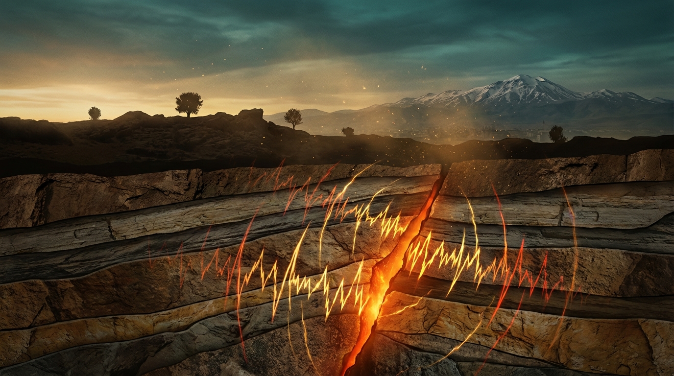
Just six kilometers beneath the surface—shallower than many subway systems—a magnitude 5.1 earthquake ruptured the crust near Erciş in eastern Turkey early Saturday morning, sending sharp jolts through a landscape still haunted by the memory of far deadlier tremors. The quake struck at 05:52 UTC on April 4, just 21 kilometers southeast of Erciş and a mere 16 kilometers from the epicenter of the catastrophic 2011 Van earthquake that claimed over 600 lives, according to USGS data. At this depth, seismic energy has barely attenuated before reaching the surface, amplifying the shaking intensity for communities above.
Why Is This Region a Seismic Pressure Cooker?
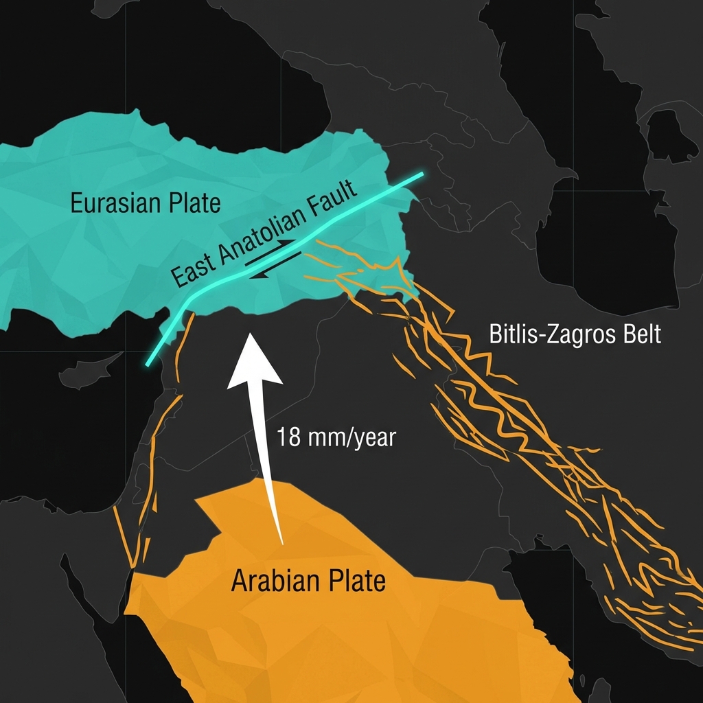
Eastern Turkey sits at the violent collision zone between the Arabian and Eurasian tectonic plates, where the former drives northward into the latter at roughly 18 millimeters per year—roughly the rate at which fingernails grow, yet relentlessly powerful over geological time. This convergence creates a complex web of strike-slip and thrust faults across the East Anatolian Plateau, including segments of the East Anatolian Fault system that accommodate the crushing horizontal motion while the Bitlis-Zagros fold and thrust belt handles the vertical compression. Seismologists classify this as a continental collision zone, meaning the crust here is not simply sliding past itself but actively crumpling, thickening, and breaking under immense strain that has built over millennia.
The region surrounding Lake Van has proven particularly susceptible to destructive ruptures throughout recorded history. In October 2011, a magnitude 7.1 event struck 27 kilometers north-northeast of Van city, releasing centuries of accumulated stress on a hidden thrust fault beneath the lake’s northern shores. That earthquake destroyed thousands of buildings and killed more than 600 people, leaving a seismic scar that today’s tremor has reopened, both geographically and psychologically. More recently, a magnitude 6.0 earthquake struck 37 kilometers east-southeast of Özalp in 2020, demonstrating that stress continues to redistribute across this fractured landscape nearly a decade after the Van disaster.
What Does Six Kilometers of Depth Mean for Shaking?
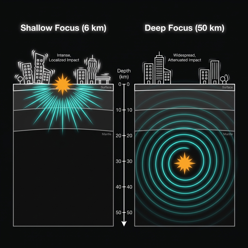
Magnitude measures the energy released at the source, but depth determines how much of that energy reaches your feet. At 6.3 kilometers depth—classed as extremely shallow by seismologists—this earthquake’s seismic waves had little rock to chew through before hitting the surface, resulting in stronger ground motion than a deeper quake of equivalent magnitude might produce. Seismologists estimate the shaking likely reached Modified Mercalli Intensity V to VI across the epicentral region, strong enough to rattle dishes, crack plaster, and send unsecured objects tumbling, though typically not catastrophic in well-constructed buildings. For perspective, a similar magnitude event at 50 kilometers depth might barely rattle windows, whereas this shallow rupture delivered a sharp jolt akin to a heavy truck striking a building.
This shallow signature aligns with the region’s recent restless behavior. Over the past week alone, monitoring networks have recorded 33 earthquakes within 200 kilometers of Erciş, including a magnitude 5.2 tremor at 7 kilometers depth near Tuşba, just west of Van city. Such clustering suggests the crust is currently adjusting to stress changes, releasing energy in bursts rather than single catastrophic failures. This type of seismicity—known as a swarm when lacking a clear mainshock-aftershock sequence—often indicates fluids moving through fractured rock or the slow migration of tectonic load across a network of small faults.
| Event | Magnitude | Depth | Distance from Erciş | Date |
|---|---|---|---|---|
| Recent Erciş quake | 5.1 Mww | 6.3 km | 21 km SSE | April 4, 2026 |
| 2011 Van earthquake | 7.1 | 16 km | ~16 km | October 23, 2011 |
| Recent swarm (Tuşba) | 5.2 | 7 km | ~35 km W | March 2026 |
What Should We Watch For Now?
While this magnitude 5.1 event did not generate a tsunami—Eastern Turkey lies hundreds of kilometers inland from any ocean—it may represent either an isolated stress release or the opening act of a longer sequence. Seismologists will be monitoring for aftershocks, which could include dozens of smaller tremors in the coming days, as well as watching whether this activity triggers movement on adjacent fault segments. The proximity to the 2011 rupture zone raises specific questions about stress transfer; when a major earthquake occurs, it redistributes load to surrounding faults, sometimes delaying but ultimately hastening subsequent failures. For residents and emergency managers, this event serves as a critical reminder to secure heavy furniture and review evacuation routes, as Turkey’s tectonic machinery continues its relentless grind beneath communities that live with geological uncertainty every day.
Frequently Asked Questions
How strong was this earthquake?
The earthquake registered as magnitude 5.1 on the moment magnitude scale (Mww), a measurement that captures the total energy released during the rupture. While moderate in size, its extremely shallow depth of 6.3 kilometers meant the shaking felt at the surface was significantly amplified compared to a deeper quake of the same magnitude, likely producing effects felt up to 100 kilometers from the epicenter.
Is there a tsunami risk from this earthquake?
No. The earthquake struck deep within the continental interior of eastern Turkey, approximately 21 kilometers southeast of Erciş and hundreds of kilometers from the nearest coastline. Tsunamis require vertical displacement of the seafloor, typically from underwater earthquakes, landslides, or volcanic collapses, making this inland event entirely devoid of tsunami potential.
Why is this area so seismically active?
Eastern Turkey sits at the collision boundary between the Arabian and Eurasian tectonic plates, where the Arabian plate drives northward into Eurasia at about 18 millimeters per year. This convergence creates a complex system of strike-slip and thrust faults across the East Anatolian Plateau, generating frequent earthquakes as the crust crumples and breaks under immense tectonic pressure.
Track this event live on the map!
Download GeoShake and get instant earthquake alerts.
Download GeoShake