
The Pulse of the Swarm
In the early hours of March 22, as the city of Denizli slept, the ground offered a subtle reminder of its restlessness. At 2:43 AM local time, a magnitude 3.0 tremor rippled through Güney district—not an isolated grumble, but merely the latest punctuation mark in an extraordinary sequence of 391 earthquakes that have shaken this corner of southwestern Turkey over the past seven days. To the casual observer, such a minor event might seem inconsequential, yet seismologists recognize it as part of a broader conversation between tectonic plates that has, in living memory, unleashed devastation across the region.
Tectonics in Tension
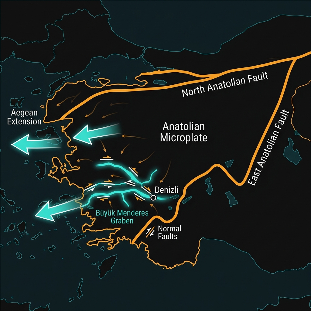
This region sits astride one of the most geologically complex and active zones in the Eastern Mediterranean. Western Turkey is being pulled apart by the forces of continental extension—a process where the Aegean Sea pushes westward, stretching the Anatolian landmass and creating a network of grabens, or downdropped valleys, including the Büyük Menderes Graben that runs near Denizli. Here, the earth’s crust is thinning and fracturing under tension, generating frequent earthquakes along normal faults that dip and slide as the terrain pulls apart.
The seismic character of this area is written in its recent history. In 1995, the nearby town of Dinar suffered a shallow magnitude 6.4 earthquake that killed nearly 100 people and destroyed thousands of homes, while just last year, magnitude 6.1 and 6.0 events struck Bigadiç and Sındırgı respectively, sending tremors across the province. These were not distant theoretical threats but visceral demonstrations that the crust here stores and releases significant energy. Seismologists note that this western Anatolian microplate is effectively escaping westward between the North Anatolian and East Anatolian fault systems, creating a diffuse but persistent seismic hazard across the Aegean hinterland.
Anatomy of a Tremor
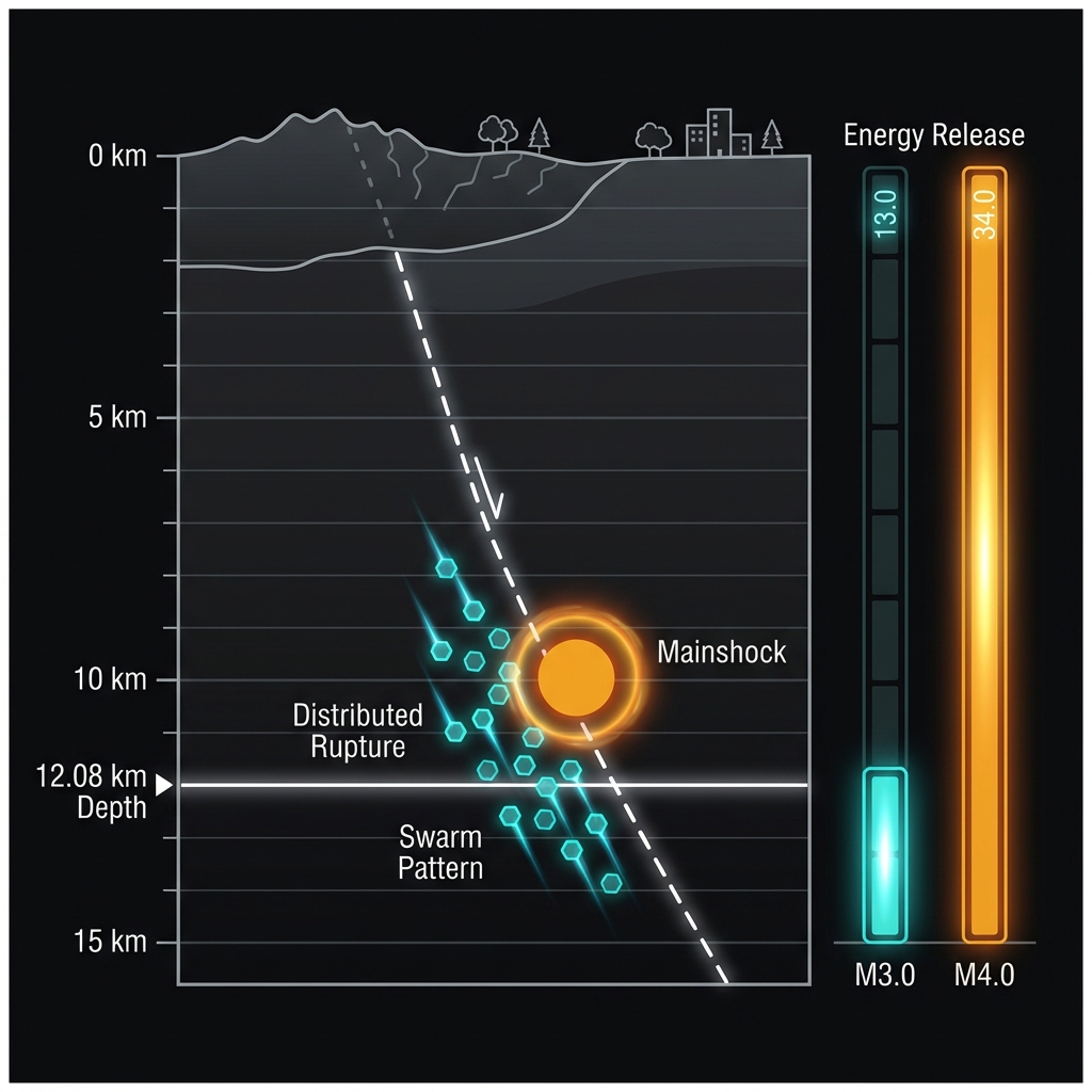
At 12.08 kilometers depth, Sunday’s tremor originated in the shallow crust—shallow enough to be felt locally as a brief jolt or rumble, but with an energy release roughly 30 times less than the magnitude 4.0 earthquake that anchored this current swarm near Sındırgı earlier in the week. Seismologists classify such sequences as earthquake swarms: clusters of events without a single dominant mainshock, suggesting a distributed release of tectonic strain rather than the classic foreshock-mainshock-aftershock progression.
The sheer number—391 separate ruptures detected by AFAD’s monitoring network—indicates the crust is adjusting incrementally, releasing pressure in small increments across a broad area rather than concentrating it into one catastrophic rupture. For residents, this translates to frequent, low-level vibrations: the M3.0 event likely produced ground motion comparable to a heavy truck passing nearby, perceptible to light sleepers but insufficient to damage well-constructed buildings. This type of persistent, low-magnitude activity tells us the regional stress field remains dynamic; while individual M3.0 events pose little hazard, their collective pattern reveals ongoing deformation that occasionally culminates in the magnitude 6-plus ruptures seen here in 1995, 2020, and 2025.
Watching the Crust Unwind
As the swarm continues, GeoShake monitoring systems will track whether this scattered seismicity migrates along fault trends or escalates in magnitude—either of which could signal a shift toward a more significant release. For now, the earth is speaking in whispers rather than shouts, offering scientists a window into the incremental processes that shape this extending landscape. Yet in a region where the ground has betrayed its stability with destructive force twice in the past year alone, each tremor—however slight—reminds us that Turkey’s western frontier remains very much a work in progress.
Track this event live on the map!
Download GeoShake and get instant earthquake alerts.
Download GeoShake