Lead
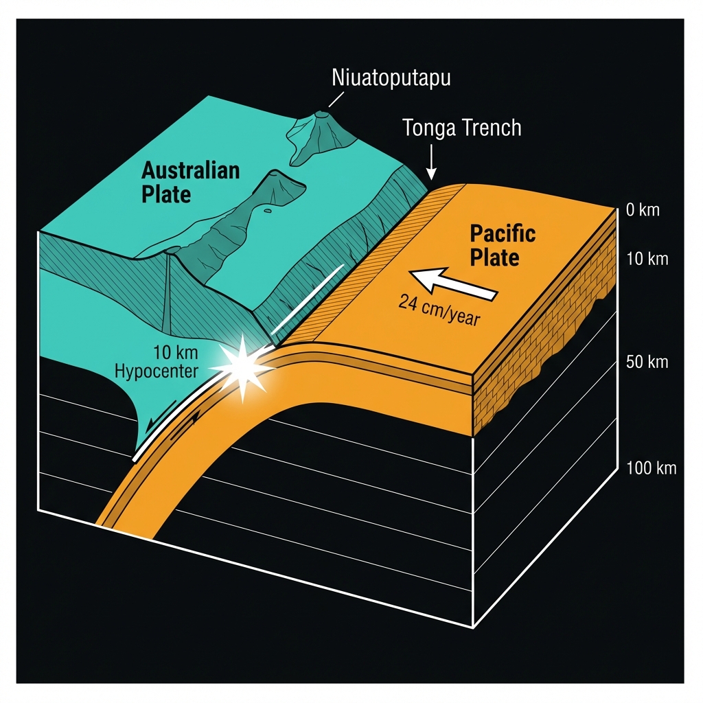
At 4:00 PM UTC on March 22nd, the seafloor northeast of Tonga’s Niuatoputapu island betrayed its usual calm. Ten kilometers beneath the waves—shallow enough that the energy had little earth to dampen its punch—a magnitude 5.6 rupture tore through the crust. The tremor struck 136 kilometers northeast of Hihifo, the administrative center of Tonga’s northernmost island group, sending a sharp jolt through a region that sits atop one of the planet’s most aggressive tectonic collisions.
Context
This specific coordinate is no stranger to violence. In 2009, just 117 kilometers from today’s epicenter, the magnitude 8.1 Samoa earthquake ruptured the subduction interface, generating a tsunami that claimed nearly 200 lives across Samoa, American Samoa, and Tonga. Since then, the area has hosted magnitude 6.8 events in 2022 and 2017, both within 50 kilometers of this latest tremor, alongside a magnitude 6.3 earthquake recorded just last week near Samoa at an identical depth.
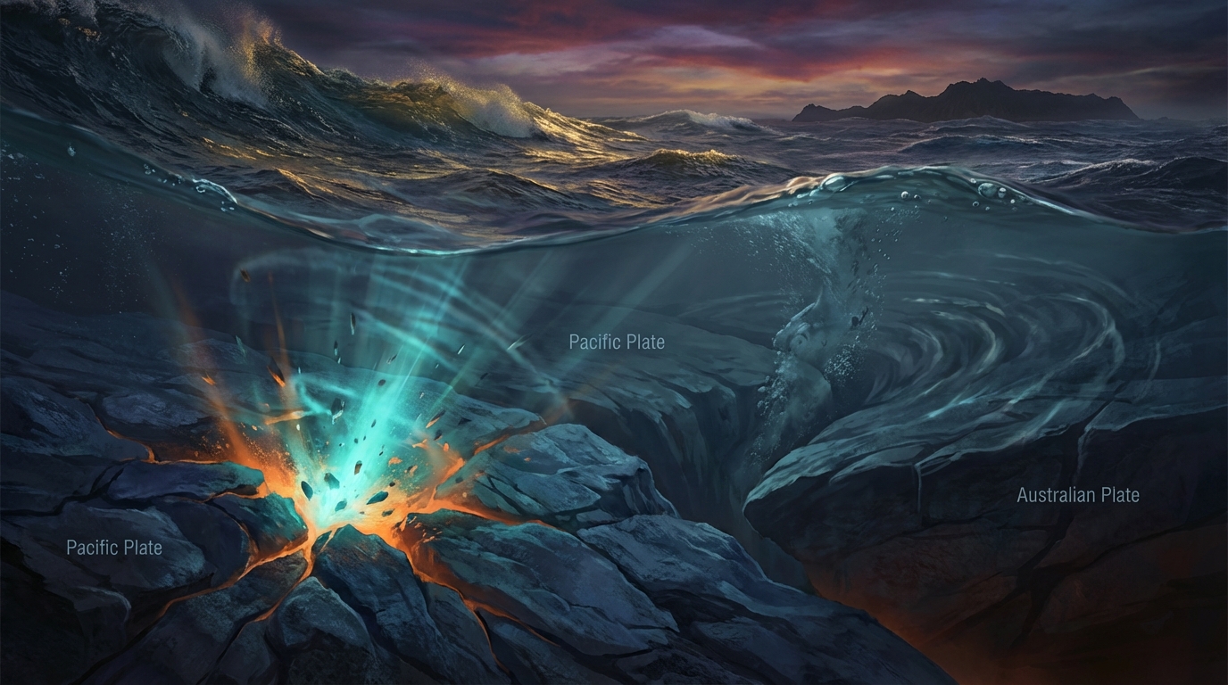
Geologically, this is the Tonga-Kermadec subduction zone, where the Pacific Plate dives beneath the Australian Plate at one of the fastest convergence rates on Earth—roughly 24 centimeters annually. When stress accumulates on the shallow portion of this interface, seismologists classify the resulting rupture as a shallow-focus earthquake, precisely the type recorded today. At ten kilometers depth, the event occurred within the upper brittle crust, where rocks break rather than flow, creating the sharp seismic waves that residents experience as violent shaking rather than slow rolling motions.
Impact Analysis
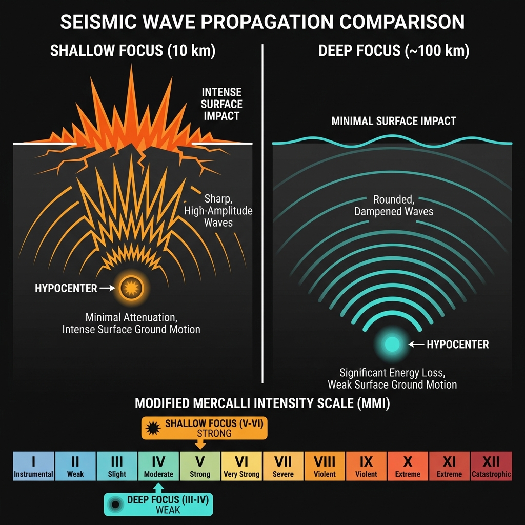
Ten kilometers is practically at the surface in seismological terms. At this depth, seismic waves retain much of their destructive potential, transforming what might otherwise be a gentle rumble into sharp, noticeable shaking capable of rattling shelves and cracking unreinforced masonry. Compared to the magnitude 6.3 event recorded days ago near Samoa, today’s earthquake released roughly one-fifth the energy—yet its shallow nature means the intensity at the surface may have felt disproportionately strong for its magnitude.
For residents of Niuatoputapu, this likely translated to Modified Mercalli intensity of V to VI—strong enough to crack plaster, disturb heavy furniture, and cause unstable objects to overturn. Given the sparse population of the Niuas island chain and the submarine location of the epicenter, the shaking may have been felt as weak tremors in Samoa to the northwest, though significant damage is unlikely given the distance from major population centers. The proximity to recent activity suggests this may be part of an ongoing stress redistribution along the plate boundary rather than an isolated incident, though identifying specific patterns requires weeks of analysis.
Safety
For residents of Niuatoputapu and the Niuas island chain, specific actions matter more than generic preparedness. Inspect traditional fale construction for splitting in wooden support posts or displacement of coral rock foundations—common vulnerabilities in shallow tremors. Check elevated water catchment tanks for tilting or cracked stands, as these represent the most immediate falling hazard in Tongan homes. Because this region produced the deadly 2009 tsunami, maintain situational awareness: if aftershocks occur and you feel prolonged ground motion or see the ocean recede, evacuate immediately to ground above 30 meters elevation without waiting for official alerts. Secure propane tanks and heavy storage containers that could topple during subsequent jolts.
Closing
GeoShake monitoring networks will track this region for aftershocks over the coming 72 hours, watching particularly for any migration of seismicity toward the trench axis that might signal larger stress releases. As the Pacific Plate continues its geological dive beneath Tonga, accumulating strain at rates measured in centimeters per year, today’s magnitude 5.6 serves as another reminder that in this part of the world, the earth rarely sleeps. The question here is never if the next earthquake will come, but whether the community will recognize the warning signs when it does.
Track this event live on the map!
Download GeoShake and get instant earthquake alerts.
Download GeoShake