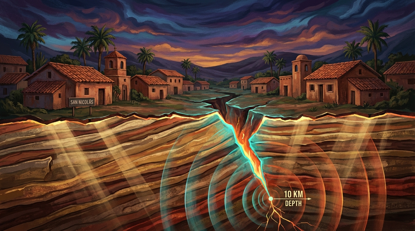
Ten kilometers beneath the surface—shallow enough to turn bedrock into a sounding board—the earth let go with a sharp snap. On March 28, 2026, a magnitude 5.1 earthquake struck just 14 kilometers southwest of San Nicolás, Mexico, sending tremors racing through a region that has unleashed multiple magnitude 7+ temblors within 100 kilometers over the past four decades, according to USGS data. The rupture occurred at a depth where seismic energy retains its ferocity, arriving at the surface with little of the dissipation that spares communities from deeper, more distant quakes. This event arrived merely weeks after a magnitude 6.5 earthquake rocked the same broad region, adding another verse to a week-long seismic swarm that has scientists and residents alike watching the earth with heightened attention.
Why Is This Corner of Mexico So Prone to Powerful Quakes?
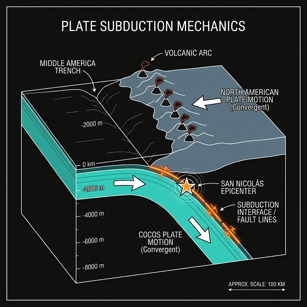
This stretch of Mexico’s southern coastline sits astride one of the planet’s most relentless tectonic collisions. Here, the Cocos Plate dives beneath the North American Plate in a process called subduction, creating the Middle America Trench offshore as a scar of their violent meeting. The friction between these grinding slabs builds strain for decades—sometimes centuries—before releasing in violent snaps that can rattle half a continent. Seismologists classify this as a subduction zone environment, a setting responsible for the world’s most powerful earthquakes and the volcanic arc that parallels this coast.
The historical record reads like a catalog of cautionary tales written in seismic waves. In 1995, a magnitude 7.4 earthquake struck just 49 kilometers from this latest event near Azoyú, toppling adobe homes and cracking highways. Seventeen years later, in 2012, another magnitude 7.4 ruptured even closer, only 46 kilometers away near Santiago Llano Grande, causing widespread damage across Oaxaca state. The 2018 Pinotepa de Don Luis earthquake—magnitude 7.2—added its own chapter just 70 kilometers distant, while a magnitude 7.5 event in 1999 demonstrated the region’s capacity for even greater releases. These were not isolated incidents but rather characteristic expressions of a boundary capable of storing and releasing immense tectonic stress with little warning.
What Does Ten Kilometers of Depth Mean for Those Above?
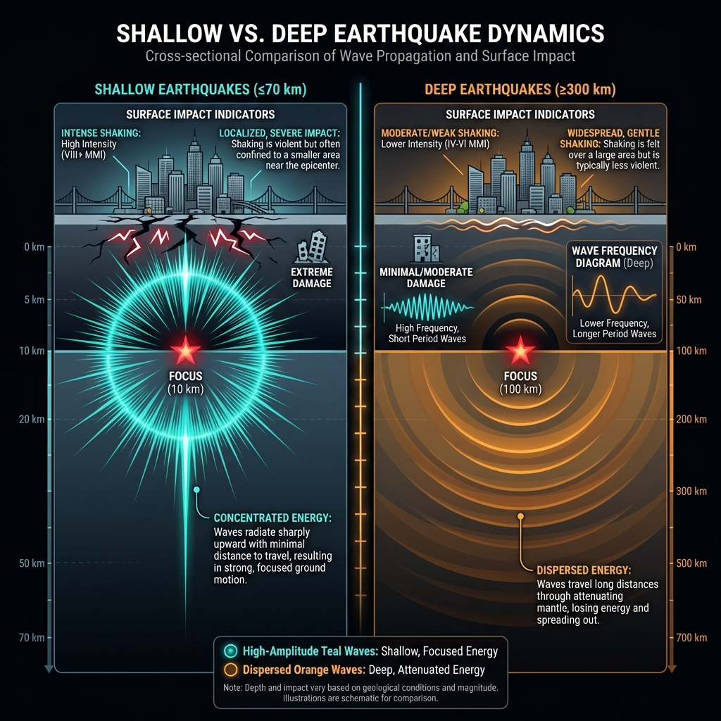
Depth determines destiny in seismology. At ten kilometers, this earthquake qualifies as shallow-focus—originating in the upper crust where seismic waves retain high frequencies capable of rattling buildings, toppling unsecured objects, and inducing that primal sense of ground betrayal that deeper quakes often lack. Deeper earthquakes, by contrast, must travel farther through the earth’s dissipating layers, often arriving at the surface as a rolling, oceanic sensation rather than a sharp, percussive jolt. Seismologists note that shallow earthquakes of this magnitude can produce Modified Mercalli Intensity VI shaking—strong enough to crack plaster, disturb heavy furniture, and alarm populations—within a localized radius extending tens of kilometers from the epicenter.
The human experience likely varied from a sudden truck-like rumble for those in San Nicolás to a gentle, dizzying sway for residents in coastal cities farther afield. While a magnitude 5.1 lacks the catastrophic potential of its magnitude 7+ predecessors, its shallow depth meant the energy concentrated locally rather than spreading across hundreds of kilometers. This same shallowness explains why the event featured prominently in a week-long swarm that has now produced four earthquakes in seven days, including the magnitude 6.5 event that struck near San Marcos just weeks earlier, roughly 96 kilometers away.
| Event | Magnitude | Depth | Distance from San Nicolás | Year |
|---|---|---|---|---|
| San Marcos | 6.5 | ~10 km | 96 km | 2026 (weeks prior) |
| San Nicolás (this event) | 5.1 | 10 km | 0 km | 2026 |
| Oaxaca (Santiago Llano Grande) | 7.4 | ~20 km | 46 km | 2012 |
| Guerrero (Azoyú) | 7.4 | ~23 km | 49 km | 1995 |
| Oaxaca (Pinotepa de Don Luis) | 7.2 | ~24 km | 70 km | 2018 |
What Should We Watch For as This Seismic Sequence Unfolds?
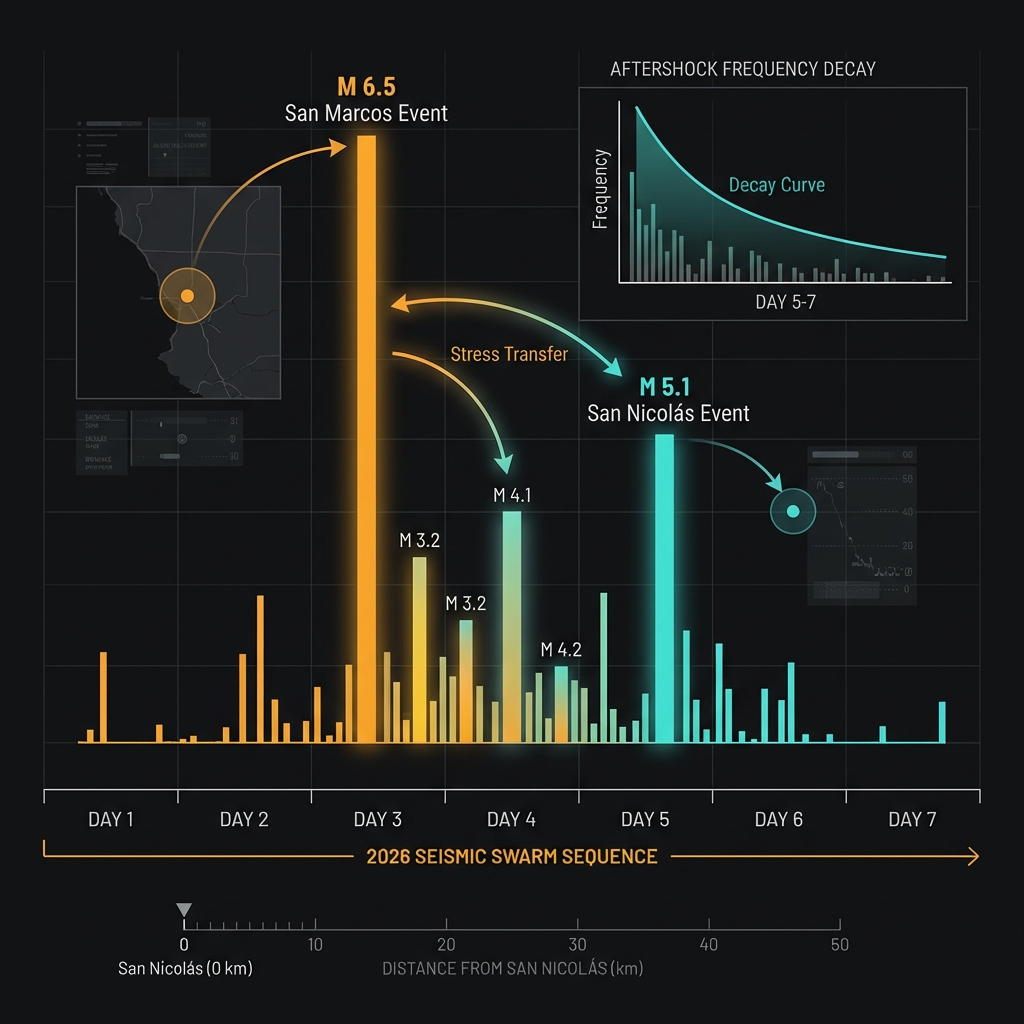
Earthquakes rarely travel alone in such active terrain. The current swarm suggests the crust is adjusting to stress redistribution, possibly triggered by the recent magnitude 6.5 event or representing independent failures along adjacent fault segments within the subduction interface. Seismologists will monitor for aftershocks—smaller earthquakes that follow a main shock as the earth settles into a new equilibrium—though distinguishing between aftershocks, foreshocks, and independent events remains an imperfect science until the sequence concludes. While this magnitude 5.1 event could theoretically precede something larger, the pattern of decreasing magnitude in recent days offers cautious reassurance that the system may be releasing pressure rather than building toward a major rupture.
For residents, the takeaway is geographical rather than immediately alarming: this coastline has produced seven earthquakes of magnitude 6.9 or greater since 1989 alone, including three magnitude 7.4 events within a hundred-kilometer radius. The region is not becoming more active so much as it is displaying its persistent, restless character—a reminder that in the tectonic lottery of subduction zones, preparedness remains the only constant hedge against the next ten kilometers of depth.
Frequently Asked Questions
How strong was this earthquake?
A magnitude 5.1 earthquake is considered moderate. It is powerful enough to cause noticeable shaking and minor damage to poorly constructed buildings near the epicenter, but typically does not result in widespread destruction. For context, it releases roughly 30 times less energy than the magnitude 7.4 earthquakes that struck this region in 1995 and 2012.
Is there a tsunami risk from this earthquake?
No tsunami warning was issued for this event. Tsunamis typically require earthquakes of magnitude 7.0 or greater, or significant vertical displacement of the seafloor during shallower underwater ruptures. This magnitude 5.1 event, while shallow, lacked the vertical thrust motion and energy necessary to displace a damaging volume of ocean water.
Why is this area so seismically active?
This region sits above the boundary where the Cocos Plate subducts beneath the North American Plate. As the oceanic plate descends into the mantle, it sticks and slips against the overriding continental plate, building elastic strain that releases periodically as earthquakes. This subduction zone has generated multiple magnitude 7+ earthquakes within 100 kilometers of San Nicolás over the past 40 years, making it one of Mexico’s most seismically hazardous coastlines.
Track this event live on the map!
Download GeoShake and get instant earthquake alerts.
Download GeoShake