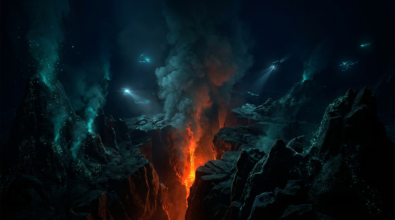
A Shallow Tremor Beneath the Southern Ocean
Ten kilometers beneath the crashing swells of the Roaring Forties, where the African and Antarctic plates drift apart in near-total isolation, the seafloor shuddered. At 6:08 UTC on March 22, a magnitude 5.0 earthquake rippled through the Southwest Indian Ridge, a jagged underwater mountain range thousands of kilometers from the nearest coastline. In this realm of perpetual twilight and crushing pressure, tectonic forces performed their ancient geology without a single human witness—save for the sensitive web of seismometers that caught the tremor and relayed it to labs continents away.
The Geography of Spreading Plates
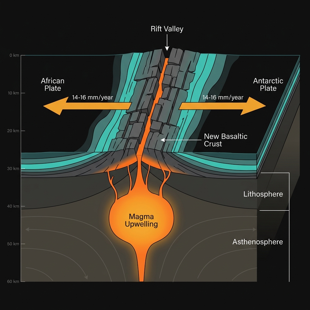
The Southwest Indian Ridge represents one of Earth’s most remote constructive plate boundaries, a place where the planet’s crust is literally being born. Here, the African and Antarctic plates separate at a languid pace—roughly 14 to 16 millimeters per year—as magma wells up from the mantle to fill the gap, cooling into fresh basaltic ocean floor. This process, known as seafloor spreading, creates the geological equivalent of a slow-motion zipper unfastening along the ocean bottom.
Seismologists classify this event as a shallow crustal earthquake, occurring at a depth where the brittle upper lithosphere—the rigid outer layer of Earth—is still thick enough to store and release elastic strain. While such magnitudes might rattle windows in populated areas, this tremor struck roughly 2,000 kilometers southeast of Madagascar, in waters so remote that the closest witnesses likely consisted of wandering albatrosses or the occasional research vessel. The region is no stranger to such disturbances; in 2020, a magnitude 6.0 earthquake struck approximately 140 kilometers from this latest epicenter, a reminder that even these slow-spreading ridges accumulate significant stress over decades and release it in sporadic bursts.
Depth, Magnitude, and the Absence of Waves
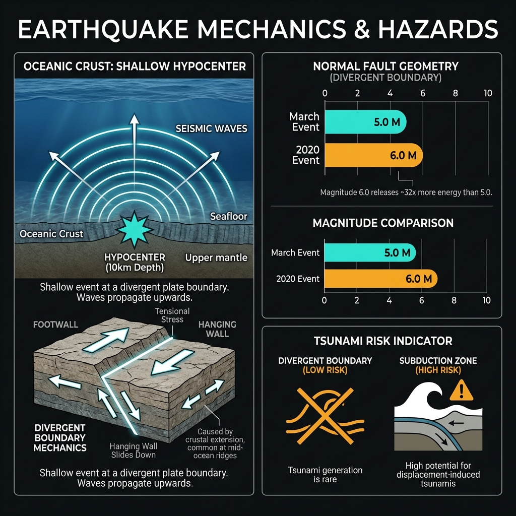
At magnitude 5.0 and just ten kilometers deep, this earthquake packed considerable punch relative to its modest ranking on the moment magnitude scale. Shallow earthquakes—those occurring less than 70 kilometers below the surface—deliver more intense shaking than deeper events of equivalent magnitude because the seismic energy has less overlying rock to dampen, or attenuate, its passage. Had this occurred beneath a city, residents would have felt sharp jolts sufficient to rattle dishes and disturb sleep; on the seafloor, the motion likely triggered brief avalanches of sediment down the ridge flanks and sent acoustic pulses through the water column detectable by hydrophones hundreds of kilometers away.
Yet the tremor posed no tsunami threat, confirming what seismologists suspected from the ridge’s spreading-center mechanics. Unlike subduction zones, where one plate dives beneath another and can vertically displace massive volumes of water, divergent boundaries typically generate normal faulting or strike-slip motion—movement that rarely triggers significant tsunamis. In the week preceding this event, seismic monitors recorded no precursory activity within 200 kilometers, marking this as a solitary spike in an otherwise quiet stretch of ocean crust. Compared to the 2020 magnitude 6.0 event, this tremor represents a moderate release of stress, suggesting the ridge continues its steady, sporadic adjustment rather than entering a heightened phase of activity.
Monitoring Earth’s Hidden Frontier
For GeoShake and the global seismic network, earthquakes like this serve as pulse checks on the planet’s hidden machinery. Each tremor captured in these desolate waters helps cartographers refine maps of the ocean floor and geophysicists refine models of how heat escapes Earth’s interior. As monitoring technology improves and ocean-bottom seismometers multiply, we are gradually peeling back the veil on these submarine frontiers. The Southwest Indian Ridge will continue its slow, relentless spreading long after today’s headlines fade—building new crust in darkness, reminding us that Earth’s most powerful forces operate indifferent to human schedules, in places most of us will never see.
Track this event live on the map!
Download GeoShake and get instant earthquake alerts.
Download GeoShake