Just ten kilometers beneath the surface of the Coral Sea, the Earth shifted. At 00:11 UTC on April 8, 2026, a magnitude 5.1 tremor ruptured almost directly below the waves, roughly 90 kilometers east of Tadine on Maré Island. According to USGS data, this extreme shallowness—practically skimming the seafloor in geological terms—meant that seismic energy had minimal rock and water to dissipate through before reaching the Loyalty Islands, potentially amplifying the shaking felt across the archipelago despite the moderate magnitude.
Why Is This Region So Seismically Volatile?
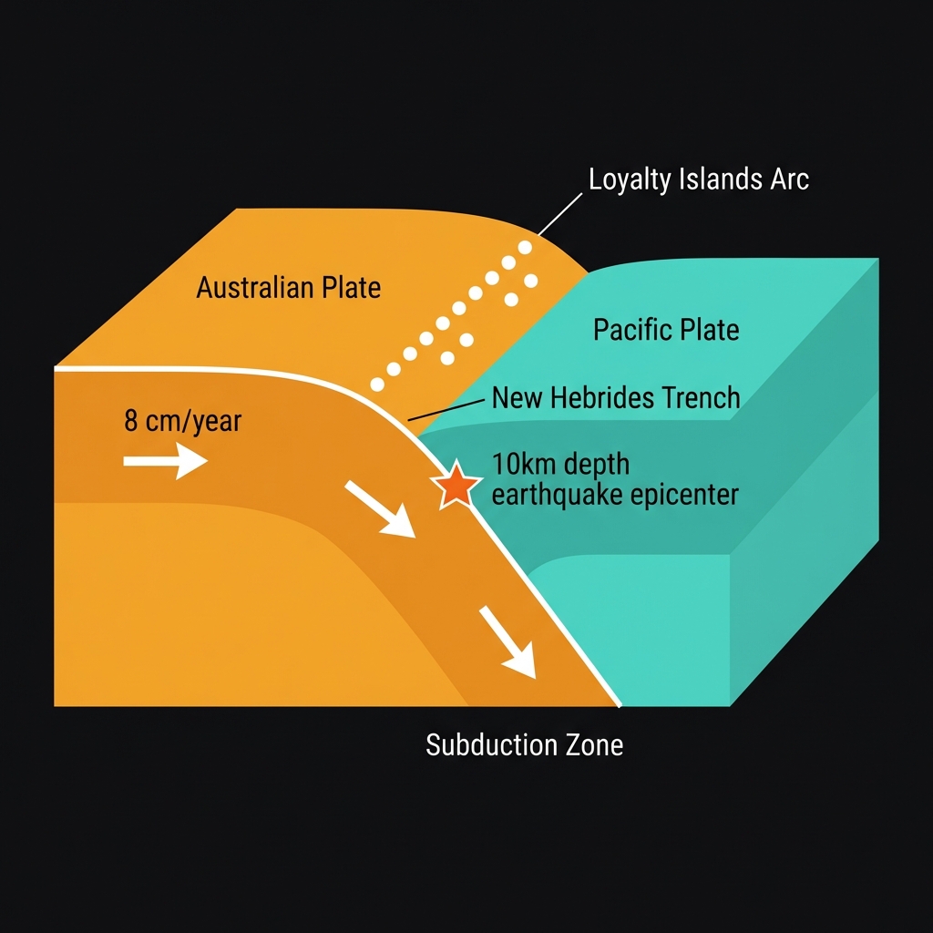
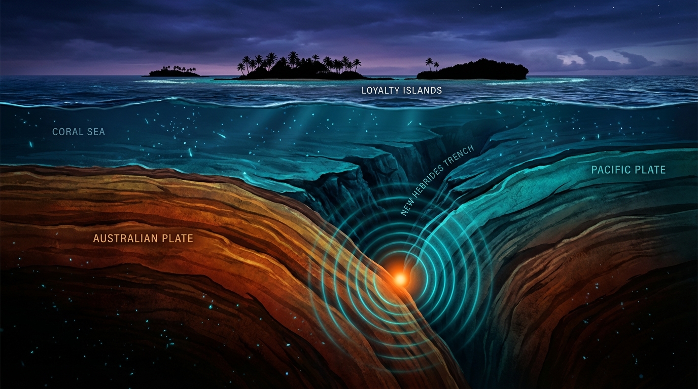
New Caledonia sits astride one of the planet’s most active tectonic collision zones. Here, the Australian Plate grinds northward, diving beneath the Pacific Plate along the New Hebrides Trench at a rate of roughly eight centimeters per year—a geological sprint that generates immense strain. This subduction zone, marking the boundary between two massive slabs of Earth’s crust, has produced some of the Southwest Pacific’s most powerful temblors, including the destructive magnitude 7.5 earthquake that struck 166 kilometers east-southeast of Tadine in December 2018.
The Loyalty Islands arc represents the overlying plate in this collision, a chain of coral atolls perched precariously atop the descending Australian Plate. When stress accumulates and suddenly releases, the resulting earthquakes often occur within the upper plate or along the shallow interface between the two plates, exactly where Tuesday’s tremor originated. Seismologists classify this as a shallow crustal event, distinct from the deeper “intraplate” earthquakes that sometimes rattle the region from depths of several hundred kilometers.
What Does Ten Kilometers Mean for Shaking?
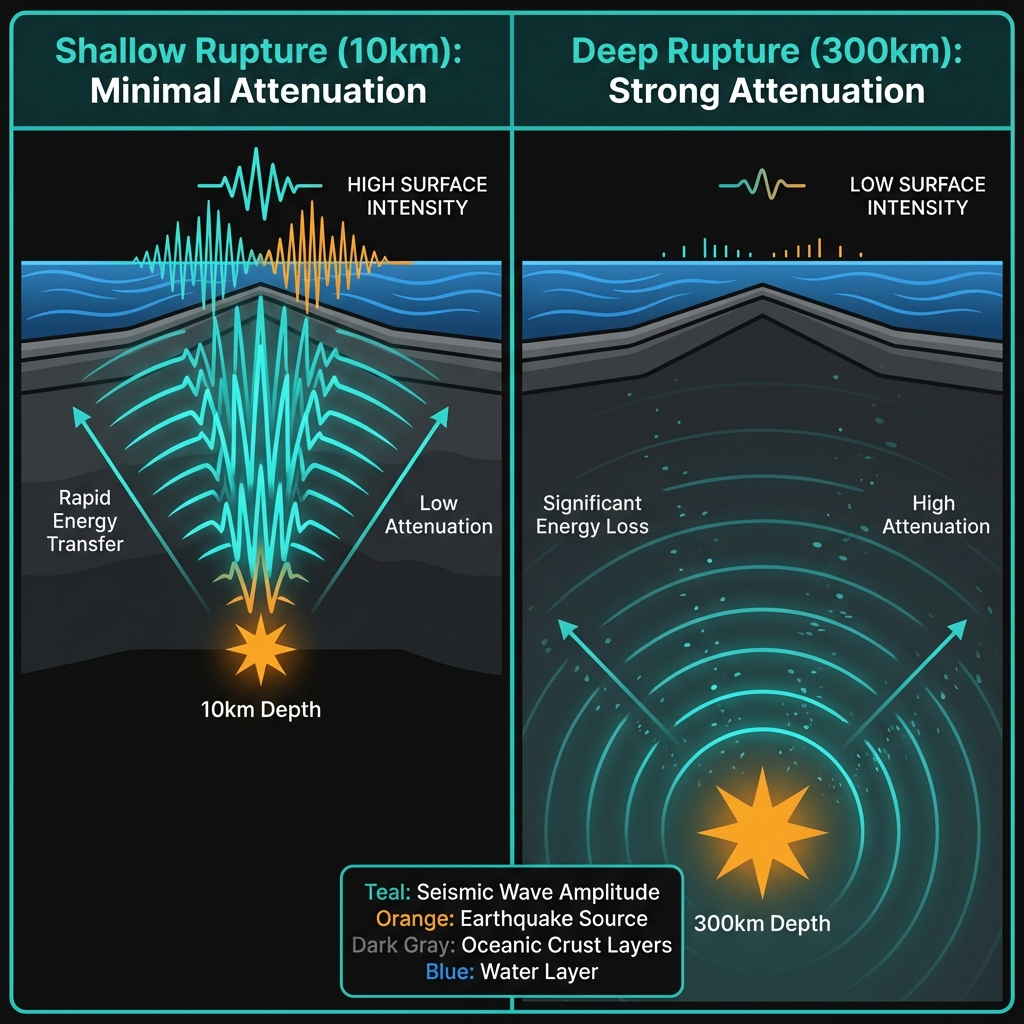
Depth determines destiny in seismology. While a magnitude 5.1 earthquake at 300 kilometers might barely rattle teacups, the same energy released at just ten kilometers depth—where this quake occurred—can produce significantly stronger ground motion at the surface. The seismic waves have less time to spread out and weaken, delivering a sharper, more abrupt jolt to anything above.
To put this in perspective, the 2018 magnitude 7.5 event occurred at approximately 10-12 kilometers depth as well, though it was located farther from populated islands. Tuesday’s tremor, while considerably smaller, followed a similar rupture geometry. Residents likely experienced light to moderate shaking—comparable to a heavy truck passing nearby or the sensation of a door slamming in a large building—with hanging objects swinging and glassware clinking, though structural damage remains unlikely for a magnitude 5.1 at this distance.
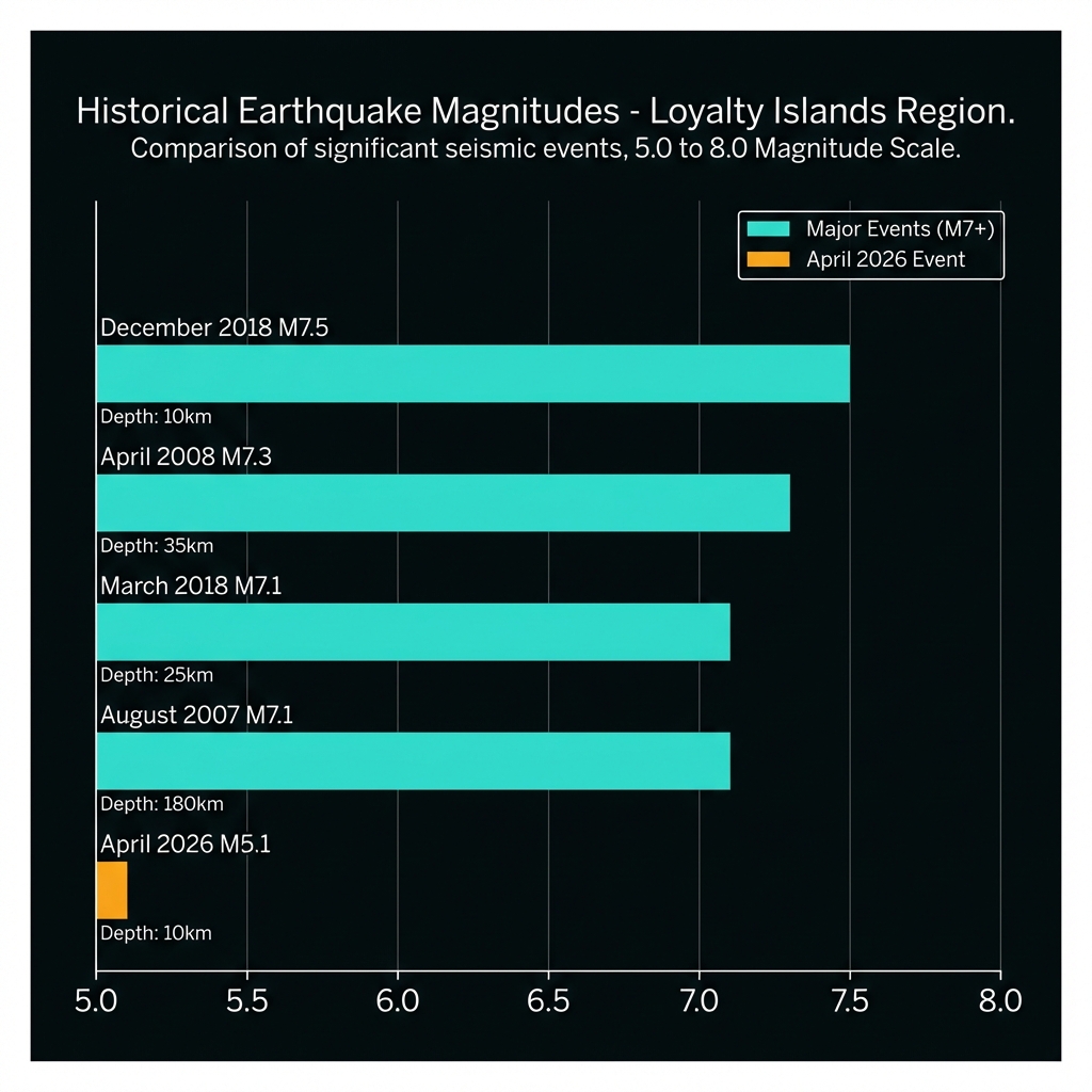
The region’s recent history reveals a pattern of significant activity. Over the past four decades, this 200-kilometer radius has hosted ten earthquakes of magnitude 6.0 or greater, including multiple magnitude 7.1 and 7.3 events. The following table illustrates how Tuesday’s tremor compares to these notable predecessors:
| Event | Magnitude | Depth | Distance from Tadine | Year |
|---|---|---|---|---|
| April 8, 2026 | 5.1 | 10 km | 90 km | 2026 |
| Dec 5, 2018 | 7.5 | ~10 km | 166 km | 2018 |
| Mar 10, 2018 | 7.1 | 25 km | 238 km | 2018 |
| Aug 29, 2007 | 7.1 | 180 km | 116 km | 2007 |
| Apr 9, 2008 | 7.3 | 35 km | 159 km | 2008 |
What Should We Watch For?
While this magnitude 5.1 event represents a relatively minor release of energy compared to the region’s historical giants, it serves as a reminder that the Loyalty Islands remain seismically pregnant. Smaller aftershocks could follow in the coming days as the crust adjusts to the new stress distribution, though given the moderate size of the mainshock, any subsequent tremors would likely fall below magnitude 4.0.
The absence of a tsunami warning reflects both the earthquake’s modest magnitude and its strike-slip or thrust mechanism, which displaced less water than a massive vertical seafloor rupture might have. For now, geoscientists continue monitoring the New Hebrides Trench, knowing that the same tectonic forces that generated this shallow shake continue building toward the next significant release.
Frequently Asked Questions
How strong was this earthquake?
The earthquake registered as magnitude 5.1 on the moment magnitude scale, classifying it as a moderate event. At 90 kilometers offshore with a shallow depth of 10 kilometers, residents of the Loyalty Islands likely experienced light to moderate shaking—enough to rattle dishes and disturb hanging objects—but significant structural damage is not expected for a tremor of this size at this distance.
Is there a tsunami risk?
No tsunami warning was issued for this event. Magnitude 5.1 earthquakes typically do not generate tsunamis unless they occur at extremely shallow depths with significant vertical seafloor displacement, and this event’s energy release was insufficient to disturb the water column in a way that would create destructive waves.
Why is this area so seismically active?
New Caledonia sits along the New Hebrides Trench, where the Australian Plate subducts beneath the Pacific Plate at approximately eight centimeters per year. This convergent boundary creates immense tectonic stress that periodically releases as earthquakes, ranging from shallow crustal tremors like this one to deep-focus events hundreds of kilometers below the surface.
Track this event live on the map!
Download GeoShake and get instant earthquake alerts.
Download GeoShake