The ground refuses to rest. Exactly one week after a devastating magnitude 7.8 earthquake shattered communities across Indonesia’s North Maluku province, the earth convulsed again Wednesday with a powerful magnitude 5.9 aftershock. This latest jolt, striking at 14:13 UTC roughly 130 kilometers west-northwest of Ternate according to USGS data, represents the 36th seismic event to rattle this volatile region in just seven days. The tremor originated 35 kilometers beneath the surface—deep enough to dampen surface destruction yet potent enough to send fresh waves of anxiety through a population already rattled by the most intense seismic swarm this fault system has produced in decades.
Why Is This Area So Seismically Active?
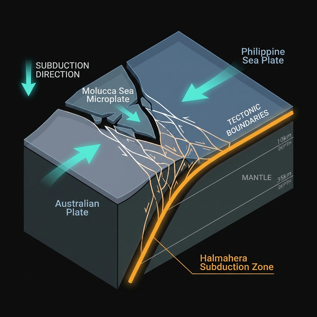
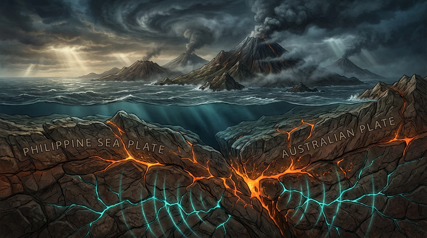
The North Maluku islands sit astride one of the planet’s most complex tectonic intersections. Here, the Philippine Sea Plate and the Australian Plate engage in a slow-motion collision, forcing the Molucca Sea microplate downward in a process geologists call subduction. This isn’t a clean, single boundary but rather a “collision zone” where multiple plates grind past and over one another, creating a spiderweb of faults capable of unleashing tremendous energy.
Seismologists classify this region as having a violent memory. Since 1986, this specific fault system has generated eight magnitude-7 or greater earthquakes, including the devastating M7.5 in 2007 and another M7.5 in 1986, both striking within 70 kilometers of today’s epicenter. The current swarm fits this brutal pattern—intense bursts of activity followed by periods of uneasy calm. The M7.8 mainshock that preceded Wednesday’s aftershock ruptured at a shallow 10 kilometers depth, explaining the widespread damage reports from earlier in the week, while today’s M5.9 event originated more than three times deeper, suggesting stress redistribution along different segments of the subducting slab.
How Does This Aftershock Compare to the Mainshock?
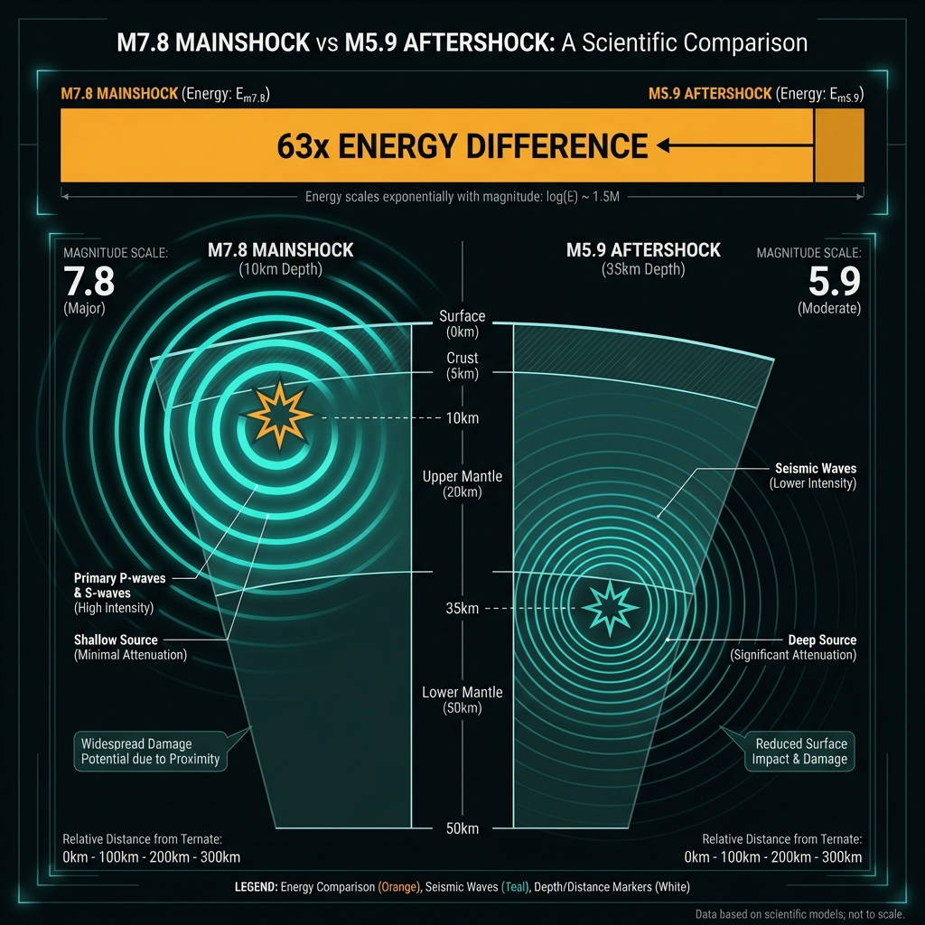
To understand the energy difference between the mainshock and Wednesday’s aftershock, consider this: a magnitude 7.8 earthquake releases roughly 63 times more energy than a magnitude 5.9 event. Yet depth changes everything. Wednesday’s tremor struck at 35 kilometers—within the brittle-ductile transition zone where rock behaves like plastic under extreme heat and pressure—while the damaging M7.8 mainshock ruptured at just 10 kilometers, close enough to the surface to generate intense shaking and potential landslides.
| Event | Magnitude | Depth | Distance from Ternate | Relative Energy |
|---|---|---|---|---|
| Mainshock (Mar 26) | 7.8 | 10 km | 119 km WNW | ~63x stronger |
| Aftershock (Apr 2) | 5.9 | 35 km | 130 km WNW | Baseline |
| 2007 Historical | 7.5 | ~20 km | 126 km WNW | ~40x stronger |
The deeper origin of Wednesday’s quake meant the seismic waves had more rock to travel through before reaching the surface, attenuating their destructive potential. Residents in Ternate likely felt moderate shaking—comparable to a heavy truck passing nearby—while those closer to the epicenter experienced strong jolts capable of knocking items from shelves and cracking weakened structures further.
What Should Residents Do Right Now?
For communities still sweeping debris from the M7.8 mainshock, Wednesday’s aftershock serves as a critical reminder that the sequence is far from over. Residents should immediately inspect buildings for new diagonal cracks in walls or foundations, particularly in structures already compromised by last week’s stronger shaking. Avoid entering damaged buildings until civil engineers have assessed structural integrity, and secure heavy furniture that may have shifted during previous tremors. Given the region’s history of magnitude-7 events, keep emergency kits stocked with water for at least three days and identify open spaces away from buildings and power lines for evacuation during stronger subsequent jolts.
What Happens Next?
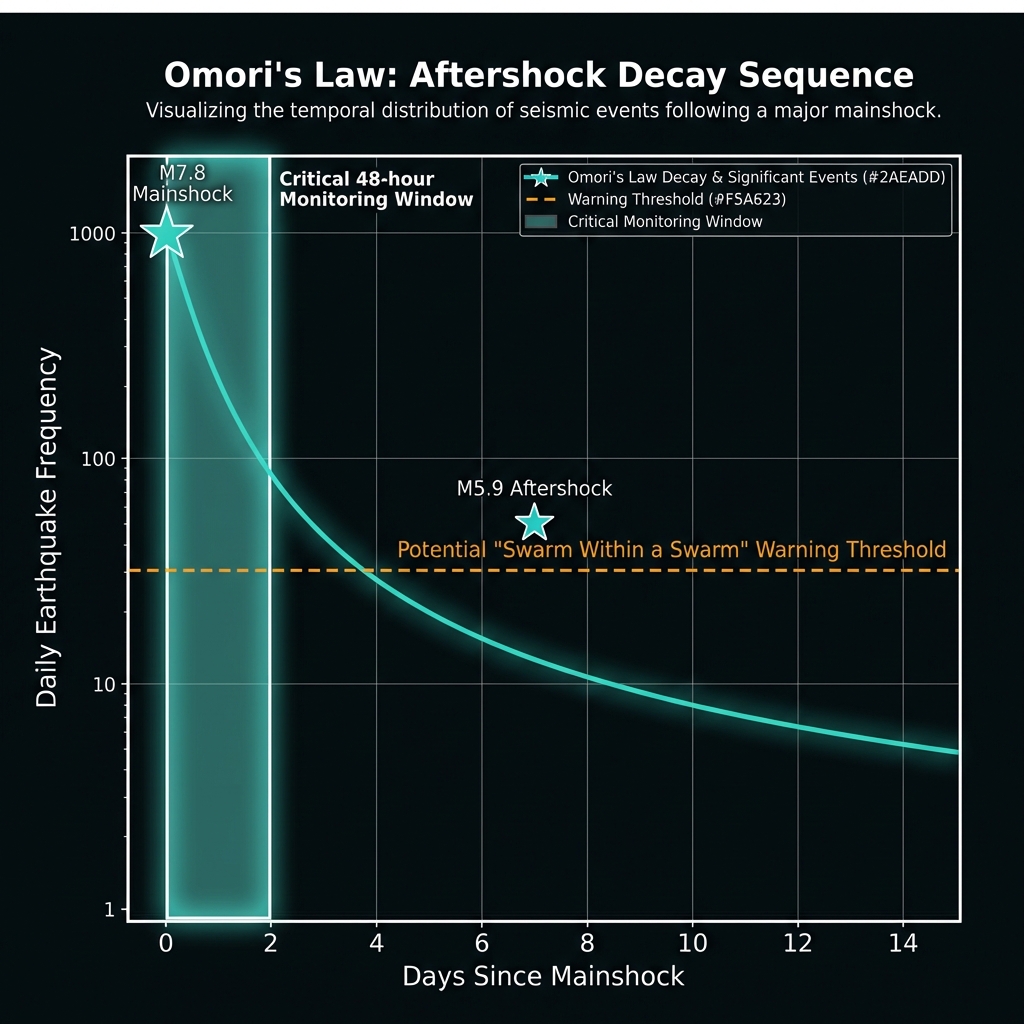
Aftershock sequences typically follow a predictable decay pattern known as Omori’s Law, where the frequency of tremors decreases with time—but not necessarily the intensity. The presence of a M5.9 event six days after the mainshock indicates this fault system remains highly stressed. Seismologists will monitor for any “swarm within a swarm” behavior that might signal a larger rupture on adjacent fault segments. For GeoShake’s monitoring team, the next 48 hours are critical: if the rate of magnitude-4 and 5 events begins climbing rather than falling, it could indicate that stress is transferring to neighboring locked sections of the Halmahera subduction zone, potentially resetting the clock on another major earthquake in a region that has already proven it can unleash magnitude-7 disasters with terrifying regularity.
Frequently Asked Questions
How strong was this earthquake?
Wednesday’s earthquake measured magnitude 5.9 on the moment magnitude scale, classifying it as a “moderate” earthquake capable of causing damage in poorly constructed buildings near the epicenter. As an aftershock to the M7.8 mainshock, it released approximately 63 times less energy than the sequence’s largest event but was still powerful enough to be felt across North Maluku province.
Is there a tsunami risk from this aftershock?
No tsunami warning was issued for this event. The earthquake’s magnitude of 5.9 falls below the typical threshold for generating significant tsunami waves, and its depth of 35 kilometers further reduces the vertical seafloor displacement necessary to displace large volumes of water. However, residents should remain alert for future larger events in this subduction zone setting.
Why is this area so seismically active?
North Maluku sits at the collision point between the Philippine Sea and Australian tectonic plates, where the Molucca Sea microplate is being forced beneath the islands in a process called subduction. This complex plate boundary has produced eight magnitude-7 or greater earthquakes since 1986, including the M7.5 events of 1986 and 2007, making it one of Indonesia’s most active seismic zones.
Track this event live on the map!
Download GeoShake and get instant earthquake alerts.
Download GeoShake