A Subtle Jolt in a Restless Archipelago
At 10 kilometers beneath the Coral Sea, the Earth shifted. Just before 2:50 PM local time on March 23rd, seismometers captured a magnitude 4.5 tremor rippling through the crust 113 kilometers west-northwest of Isangel, Vanuatu—a shallow jolt that arrived only days after a significantly larger M6.1 shook the same undersea region. For the residents of Tanna Island and the surrounding archipelago, it was another reminder that they live atop one of the planet’s most geologically restless boundaries, where the ground offers no guarantees of stillness.
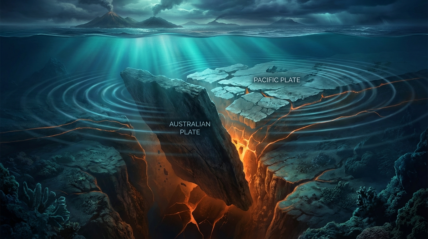
The Tectonic Engine Beneath Vanuatu
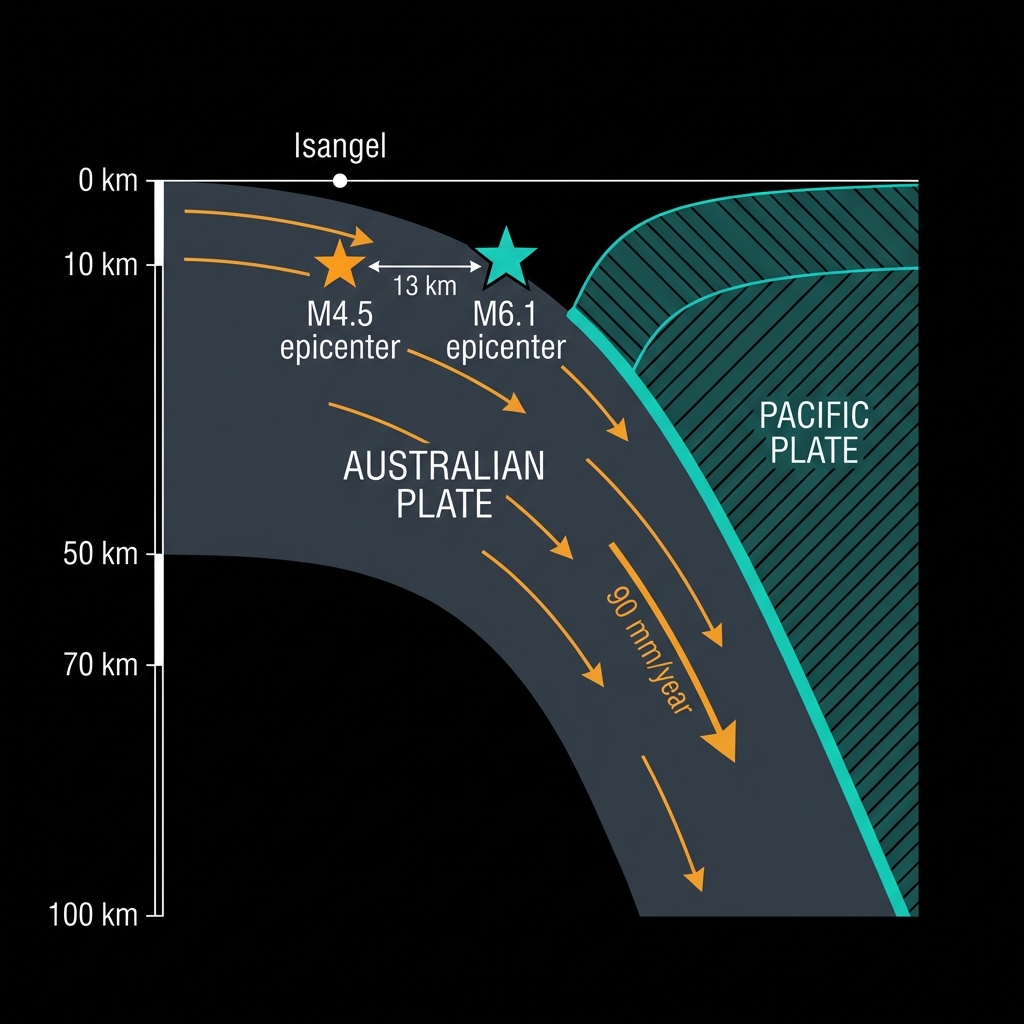
Vanuatu does not merely experience earthquakes; it is sculpted by them. The island nation straddles the New Hebrides Trench, a violent subduction zone where the Australian Plate plunges beneath the Pacific Plate at rates of roughly 90 millimeters per year—about the speed at which fingernails grow, but with infinitely more force. This collision creates a classic “Ring of Fire” setting: a convergent boundary that has generated no fewer than ten magnitude 7 or greater events within 200 kilometers of Isangel since 1990 alone, including a M7.4 temblor in 1992 that struck just 77 kilometers from the town and a M7.3 event in 2010 located 50 kilometers away.
The region’s recent behavior suggests this particular segment of the trench remains active. Only seven days prior, a M6.1 earthquake ruptured at a similar shallow depth merely 13 kilometers from today’s epicenter, releasing roughly 40 times more energy. Seismologists classify such shallow events—those occurring less than 70 kilometers down—as “crustal” or “shallow-focus” earthquakes. At merely 10 kilometers depth, today’s quake originated within the brittle upper crust, meaning less energy dissipated before reaching the surface compared to deeper temblors. This proximity to the seafloor amplifies the local intensity, even if the magnitude itself remains moderate, and suggests the rupture likely occurred within the overriding Pacific Plate or along the shallow portion of the megathrust interface.
Translating Magnitude into Meaning
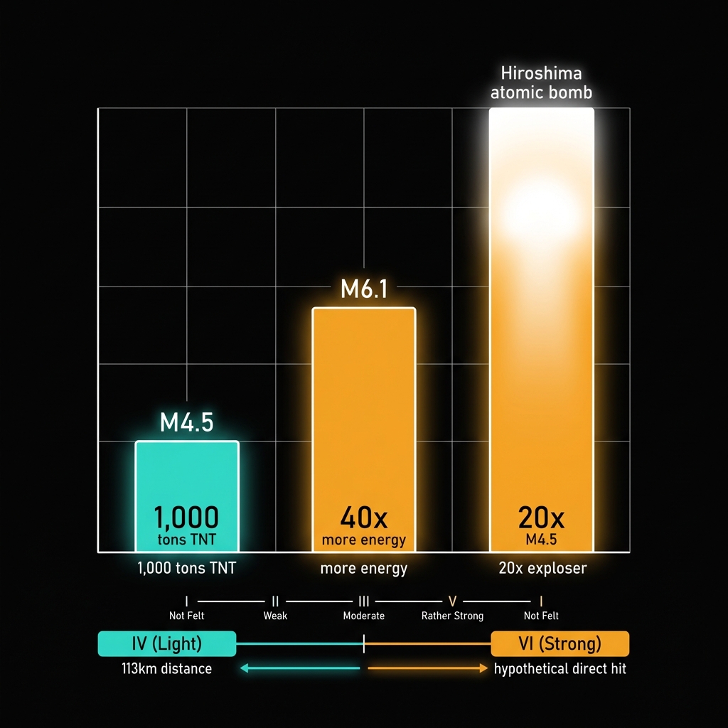
To translate the abstract numbers into tangible experience: a magnitude 4.5 release roughly the energy of 1,000 tons of TNT, or about one-twentieth the power of the atomic bomb dropped on Hiroshima. At 113 kilometers from Isangel—the administrative hub of Tanna Province—shaking would likely have registered as a gentle sway or brief rattle on the Modified Mercalli Intensity scale, perhaps noticed by those in upper floors of buildings but causing little more than momentary pause in daily activities. Had this same event occurred directly beneath a populated center at this shallow depth, the intensity could reach VI (Strong), capable of cracking plaster and shifting heavy furniture.
When viewed against the backdrop of last week’s M6.1, today’s event fits the profile of a stress adjustment—either an aftershock to the larger event or a separate rupture triggered by redistributed strain along the complex fault network. Historical records underscore the region’s capacity for sudden escalation; the 2024 M7.3 near Port-Vila and the 2023 M7.1 south of Isangel demonstrate that this stretch of the Pacific margin routinely produces major seismic events. While a 4.5 magnitude tremor represents routine tectonic business for Vanuatu, its shallow nature and proximity to a recent significant quake warrant careful monitoring for any subsequent adjustments in the coming days.
The Watch Continues
As the global network of seismographs continues recording the subtle creaks and groans of the New Hebrides Trench, GeoShake maintains its watch on this volatile convergence zone. While today’s tremor posed no tsunami threat and limited immediate hazard to coastal communities, it serves as a delicate tap on the shoulder from tectonic forces that have shaped these islands for millennia—and will continue to do so long after the aftershocks fade. In Vanuatu, the ground beneath one’s feet is never truly still; it is merely waiting between movements.
Track this event live on the map!
Download GeoShake and get instant earthquake alerts.
Download GeoShake