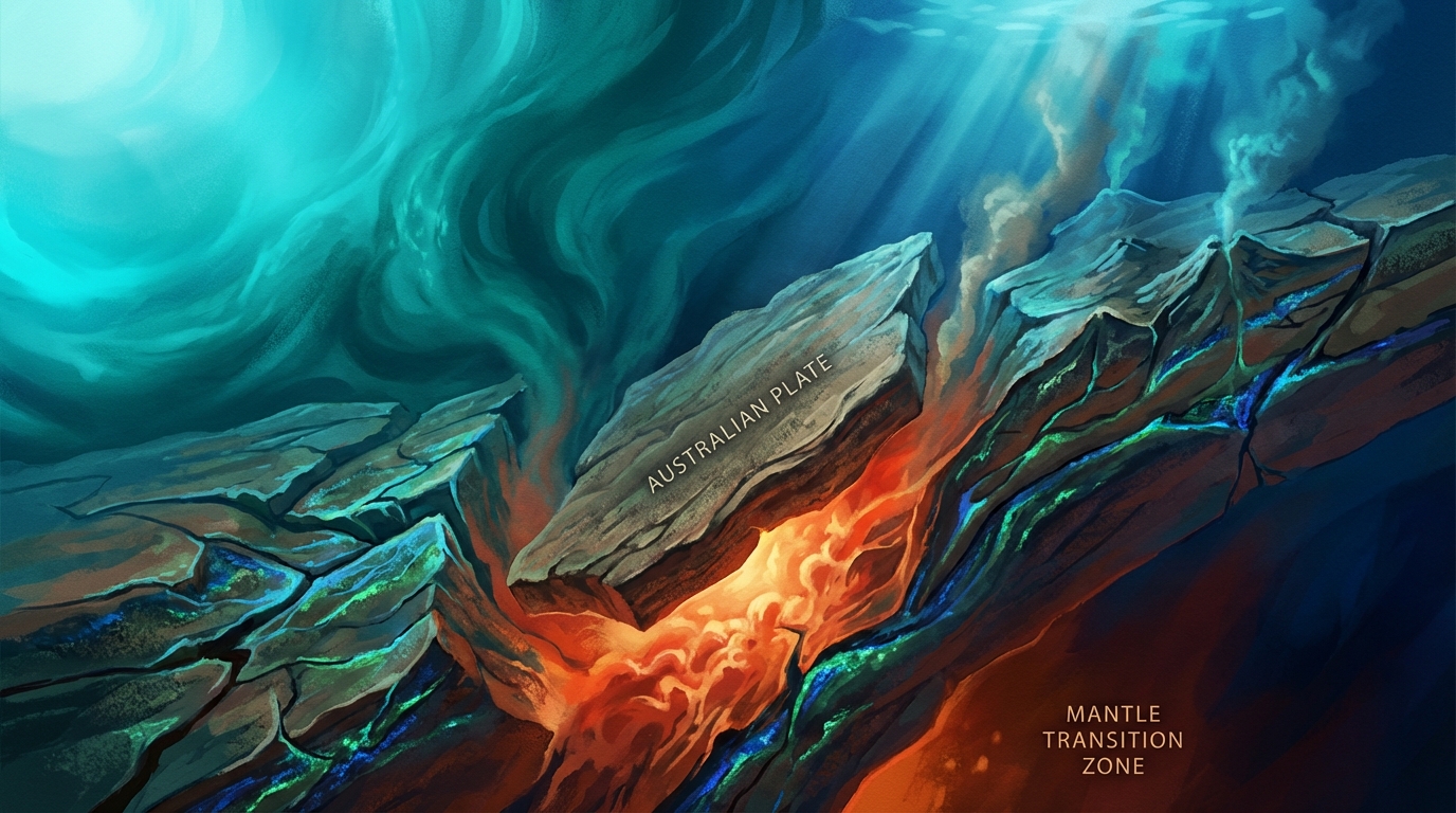
Beneath the turquoise waters of the Flores Sea, something extraordinary happened in the predawn hours of March 26. At a depth of nearly 550 kilometers—far below the reach of any tsunami or surface rupture—a magnitude 4.8 earthquake rippled through the mantle transition zone, according to USGS data. This extreme depth places the temblor in the rocky furnace between Earth’s upper and lower mantle, a region where few earthquakes occur, and marks a striking departure from the shallow, destructive seismicity that has plagued this corner of Indonesia for decades.
Why Is This Region So Seismically Active?
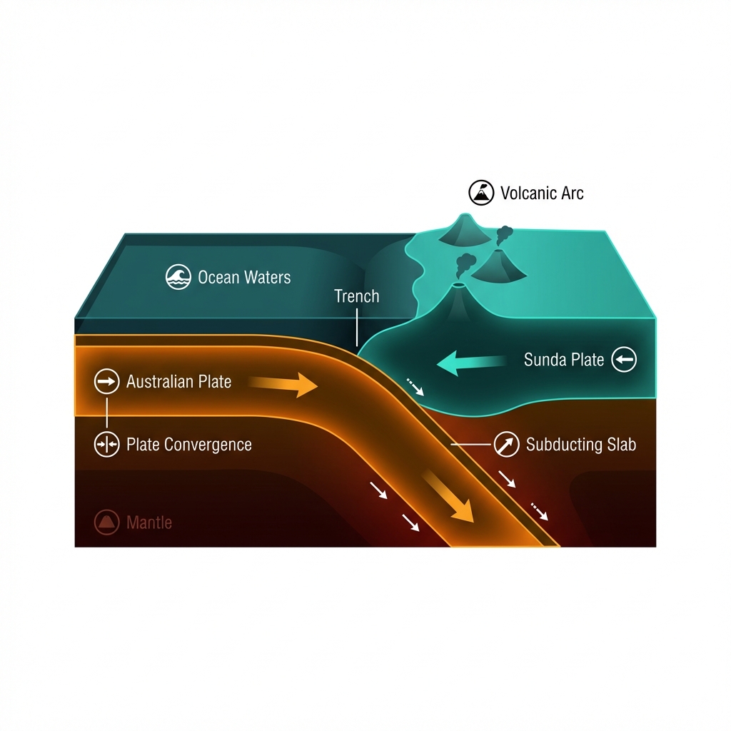
The Indonesian archipelago sits at the collision point of tectonic giants. Here, the Australian Plate dives beneath the Sunda Plate in a process called subduction, creating one of the planet’s most complex and hazardous seismic environments. This convergence has sculpted the volcanic islands of Flores and Komodo, but it also stores tremendous elastic energy that releases as earthquakes.
Historically, this specific area has delivered devastation from above, not below. In 1990, a magnitude 7.1 earthquake struck just 11 kilometers from today’s epicenter, but at a shallow depth of roughly 11 kilometers. That event, along with a cluster of magnitude 6-plus quakes recorded in 2006, 2013, and 2018, represents the more familiar threat to local communities: crustal earthquakes that rupture near the surface, amplifying shaking and endangering the port town of Labuan Bajo and surrounding villages.
What Does This Extreme Depth Mean?
Seismologists classify earthquakes deeper than 300 kilometers as “deep-focus” events, and those exceeding 500 kilometers are particularly rare. At 549.8 kilometers, this quake originated within the mantle transition zone, a pressure-cooked boundary roughly 410 to 660 kilometers down where olivine minerals undergo structural transformations. From such depths, seismic energy must travel upward through hundreds of kilometers of solid rock before reaching the surface, dissipating much of its destructive potential along the way.
The practical result? Despite its magnitude 4.8 rating—roughly equivalent to the explosive force of 1,000 tons of TNT—the shaking felt on the islands above was likely subtle, noticed only by sensitive instruments or observant sleepers. This stands in stark contrast to what a shallow magnitude 4.8 would produce at the surface, or what the region experienced in 1990 when the M7.1 shallow event unleashed violent shaking capable of damaging buildings and triggering landslides.
| Feature | March 26, 2026 Event | 1990 Flores Sea Earthquake |
|---|---|---|
| Magnitude | 4.8 | 7.1 |
| Depth | 549.8 km (Deep) | ~11 km (Shallow) |
| Distance from Labuan Bajo | 140 km NNE | ~140 km NNE |
| Tsunami Potential | None | Possible |
| Surface Impact | Minimal/Light | Severe |
This type of earthquake tells us about the fate of the subducting slab itself. As the Australian Plate descends into the mantle, it encounters increasing temperatures and pressures. Deep-focus events like this one suggest the slab is still cold and brittle enough to fracture even at these extreme depths, likely due to mineral phase changes or internal stresses within the downgoing plate.
What Should We Watch For?
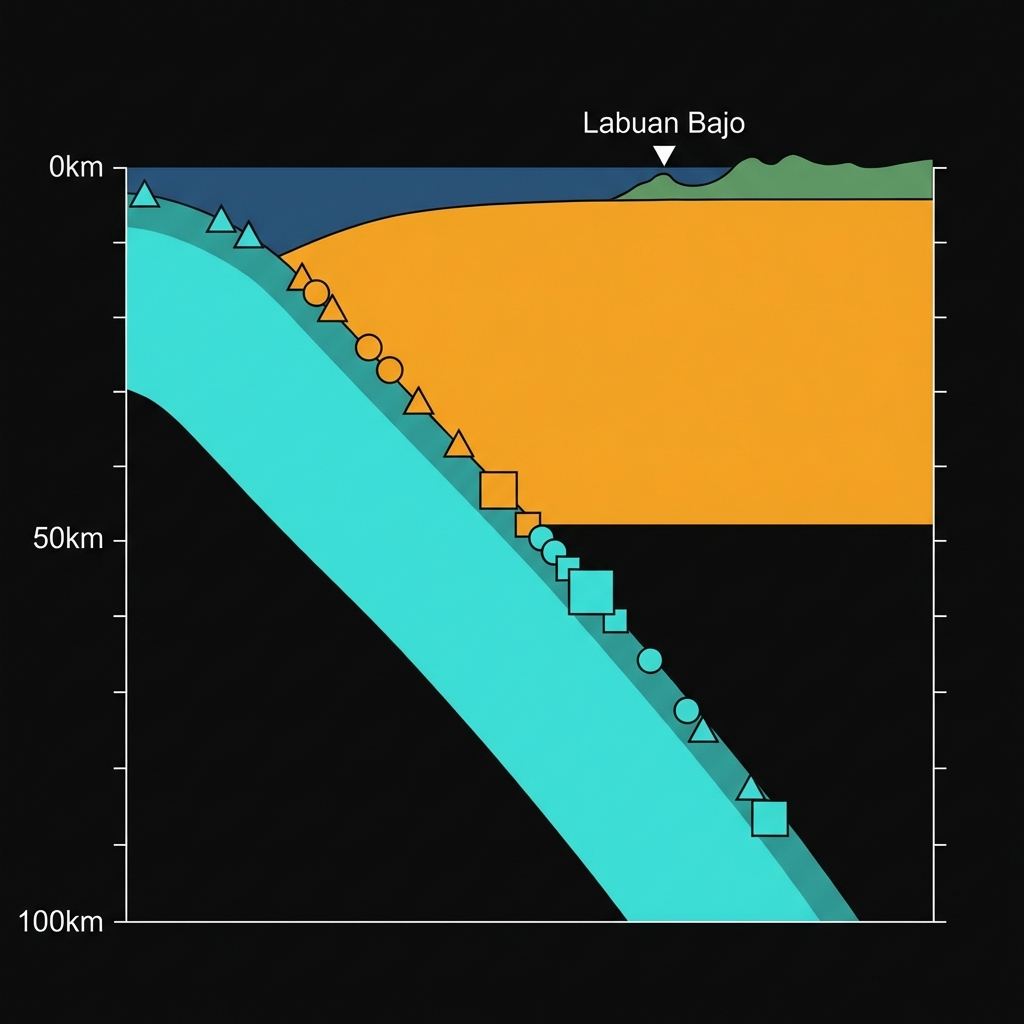
Deep earthquakes rarely trigger significant aftershocks, and the absence of tsunami warnings reflects the quake’s subterranean isolation. However, this event serves as a reminder that the Flores Sea remains seismically restless. The historical record reveals a pattern of destructive shallow earthquakes clustering in this vicinity—including the 1990 M7.1, a 2006 M6.3 just 22 kilometers away, and a 2018 M6.5 at 55 kilometers distance.
Monitoring efforts should remain focused on the upper 50 kilometers of the crust, where the Australian Plate’s descent creates locked zones capable of unleashing the shallow, damaging earthquakes that pose the real threat to Indonesia’s eastern islands. While this deep temblor offered a glimpse into the planet’s interior mechanics, the next significant event in this region will likely originate much closer to home.
Frequently Asked Questions
How strong was this earthquake?
The earthquake registered as magnitude 4.8 on the body-wave magnitude scale, according to USGS data. While this represents a moderate release of energy, the extreme depth of 549.8 kilometers meant that seismic waves attenuated significantly before reaching the surface, resulting in minimal felt shaking on the islands above compared to a shallow earthquake of similar magnitude.
Why is this area so seismically active?
The Flores Sea sits at the convergent boundary where the Australian Plate subducts beneath the Sunda Plate. This tectonic collision has created a subduction zone that generates both deep earthquakes within the descending slab and shallow, destructive earthquakes in the overriding crust. The region has experienced multiple magnitude 6-plus earthquakes in recent decades, including a devastating magnitude 7.1 event in 1990.
Is there a risk of a tsunami from this earthquake?
No tsunami warning was issued for this event. Earthquakes originating deeper than approximately 100 kilometers rarely displace sufficient water volume to generate tsunamis, and this quake occurred at 549.8 kilometers depth—far below the ocean floor. The primary tsunami risk in this region comes from shallow subduction zone earthquakes that vertically displace the seafloor.
Track this event live on the map!
Download GeoShake and get instant earthquake alerts.
Download GeoShake