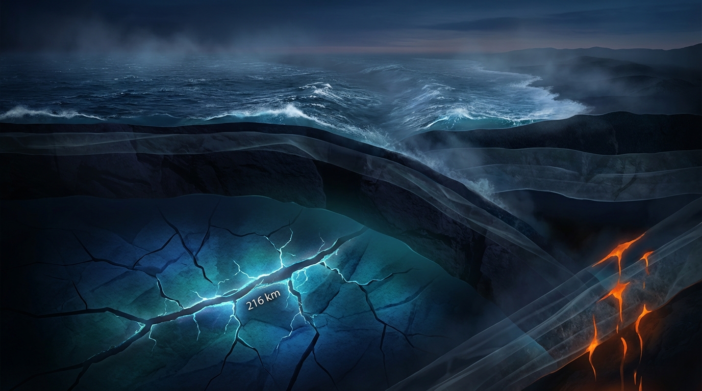
Only 24 kilometers from the epicenter of a magnitude 7.5 monster that rattled the region just seven days ago, the earth shook again. At 5:22 UTC on March 24, 2026, a magnitude 5.2 earthquake ruptured 216 kilometers beneath the surface approximately 157 kilometers west of Neiafu, Tonga, according to USGS data. This latest tremor appears to be a clear aftershock of the deeper, more powerful quake that struck the same subterranean realm on March 17, underscoring that the Tonga subduction zone remains in a state of geological adjustment.
Why Is This Subduction Zone So Seismically Active?
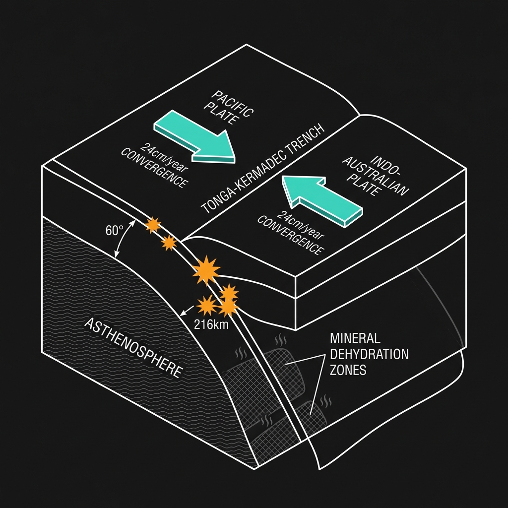
The Tonga archipelago sits astride one of the most active and fastest-converging plate boundaries on Earth. Here, the Pacific Plate plunges westward beneath the Indo-Australian Plate at rates exceeding 24 centimeters per year—among the highest velocities measured globally. This collision creates the Tonga-Kermadec Trench, a submarine chasm where dense oceanic crust is forced deep into the mantle in a process called subduction.
As the descending plate sinks, it heats up, dehydrates, and occasionally cracks under immense pressure, generating earthquakes at depths ranging from 70 to 300 kilometers. Seismologists classify these as intermediate-depth earthquakes, and they are a hallmark of mature subduction zones. The region’s history bears this out: significant events like the M6.9 quake near Neiafu in 2023 and the M6.6 tremor in 2019 demonstrate that this stretch of the Pacific Ring of Fire is a persistent source of deep-seated energy release.
What Does 216 Kilometers of Depth Mean for Surface Shaking?
At a depth of 216 kilometers, this earthquake originated well below the brittle crust that humans inhabit. The overlying rock absorbed much of the seismic energy before it reached the surface, meaning that despite its magnitude, the shaking experienced on islands like Vava’u was likely subtle—a gentle rocking rather than violent jarring. Deep earthquakes of this type can often be felt over vast distances because seismic waves travel efficiently through the solid mantle, yet they rarely inflict significant damage.
To understand the relationship between this aftershock and its predecessor, consider how these events compare:
| Event | Magnitude | Depth | Distance Apart | Date |
|---|---|---|---|---|
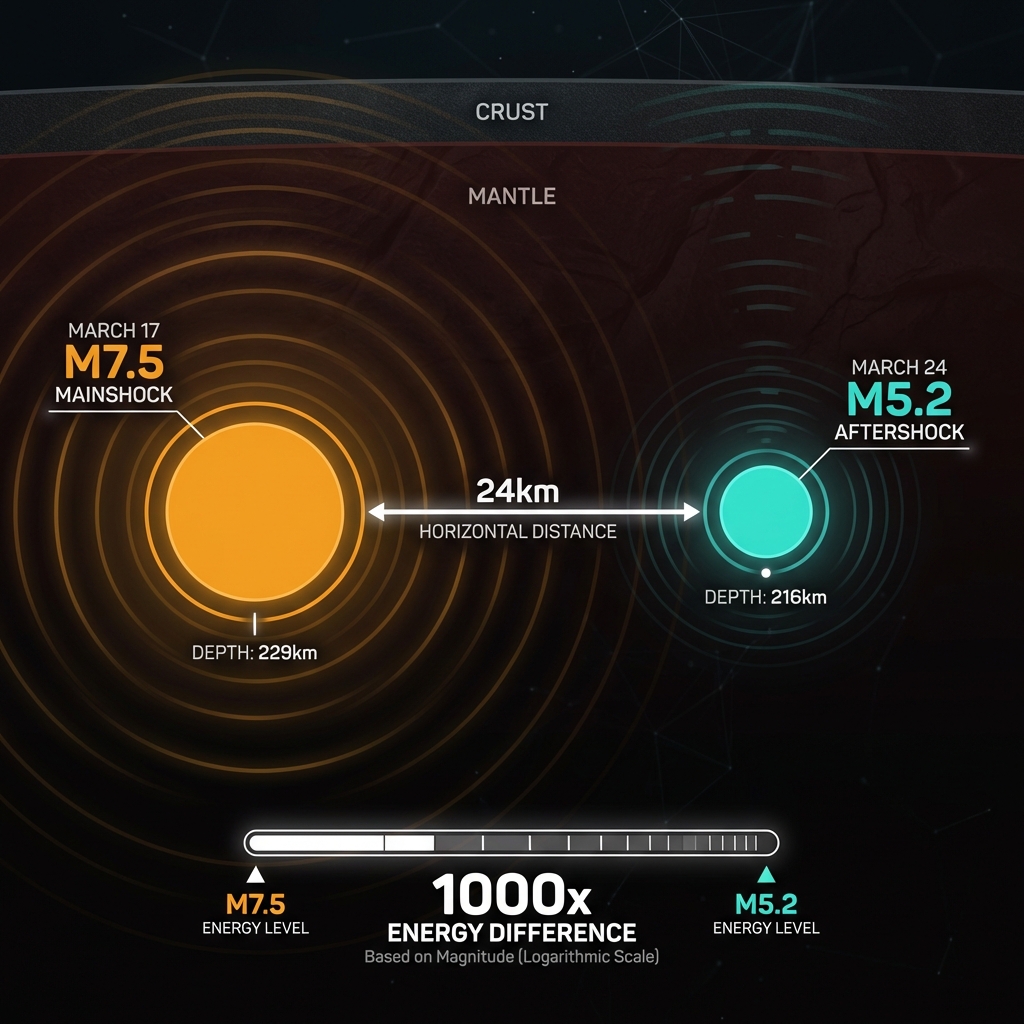
| Mainshock | 7.5 | 229 km | — | March 17, 2026 |
| Aftershock | 5.2 | 216 km | 24 km | March 24, 2026 |
The energy released by the magnitude 7.5 mainshock was roughly 1,000 times greater than this M5.2 aftershock, illustrating the dramatic logarithmic scale of seismic magnitude. While the earlier event likely caused widespread notice across Tonga and potentially as far as Fiji, this smaller rupture represents the crust continuing to settle and redistribute stress along the subducting slab.
What Should We Watch For Next?
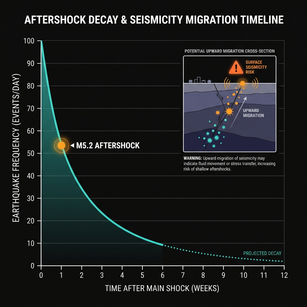
Aftershock sequences in intermediate-depth zones like Tonga typically decay over weeks to months, with smaller tremors becoming progressively less frequent. However, the occurrence of this M5.2 event just one week after the M7.5 serves as a reminder that the subduction zone is still rebalancing its mechanical load. Seismologists will monitor for any migration of seismicity toward the surface or unusual clustering that might indicate a shift in stress patterns.
Historically, this region has produced significant earthquakes decades apart—the 1989 M6.9 and 2001 M6.9 events stand as evidence that the subduction process here is remarkably consistent over time. While the current sequence is following expected patterns, the geological memory of these islands suggests that vigilance remains essential for communities living atop this dynamic, descending plate.
Frequently Asked Questions
How strong was this earthquake?
A magnitude 5.2 earthquake releases roughly 3.1 petajoules of energy, equivalent to about 750,000 tons of TNT. At a depth of 216 kilometers, however, much of this energy dissipated before reaching the surface, resulting in light to moderate shaking that was likely felt by residents but caused no significant damage.
Is there a tsunami risk from this earthquake?
No tsunami warning was issued for this event. Earthquakes occurring at depths greater than 200 kilometers rarely displace the seafloor sufficiently to generate tsunamis. The vertical movement required to move a massive column of water is typically associated with shallow subduction zone earthquakes less than 50 kilometers deep.
Why does Tonga experience earthquakes so deep underground?
Tonga sits above the Tonga-Kermadec subduction zone, where the Pacific Plate is diving beneath the Indo-Australian Plate at one of the world’s fastest convergence rates. As this cold, dense oceanic slab descends into the hot mantle, it undergoes mineral transformations and brittle fracture at depths exceeding 200 kilometers, creating the intermediate-depth earthquakes that characterize this region.
Track this event live on the map!
Download GeoShake and get instant earthquake alerts.
Download GeoShake