Lead
Ten kilometers beneath the surface of the southern Indian Ocean, where the seafloor is slowly being torn apart in one of Earth’s most isolated laboratories of plate tectonics, the crust fractured with a magnitude 4.7 jolt. The rupture occurred along the Southwest Indian Ridge, a submerged mountain chain lying roughly midway between the ice shelves of Antarctica and the eastern coast of Africa, at 00:14 UTC on March 22—a tremor detectable only by seismic networks and the occasional passing research vessel.
The Planet’s Hidden Mountain Range
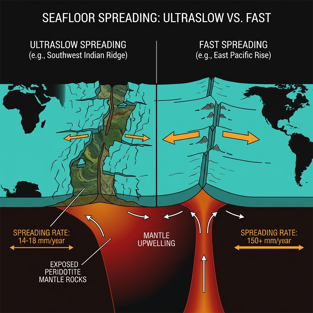
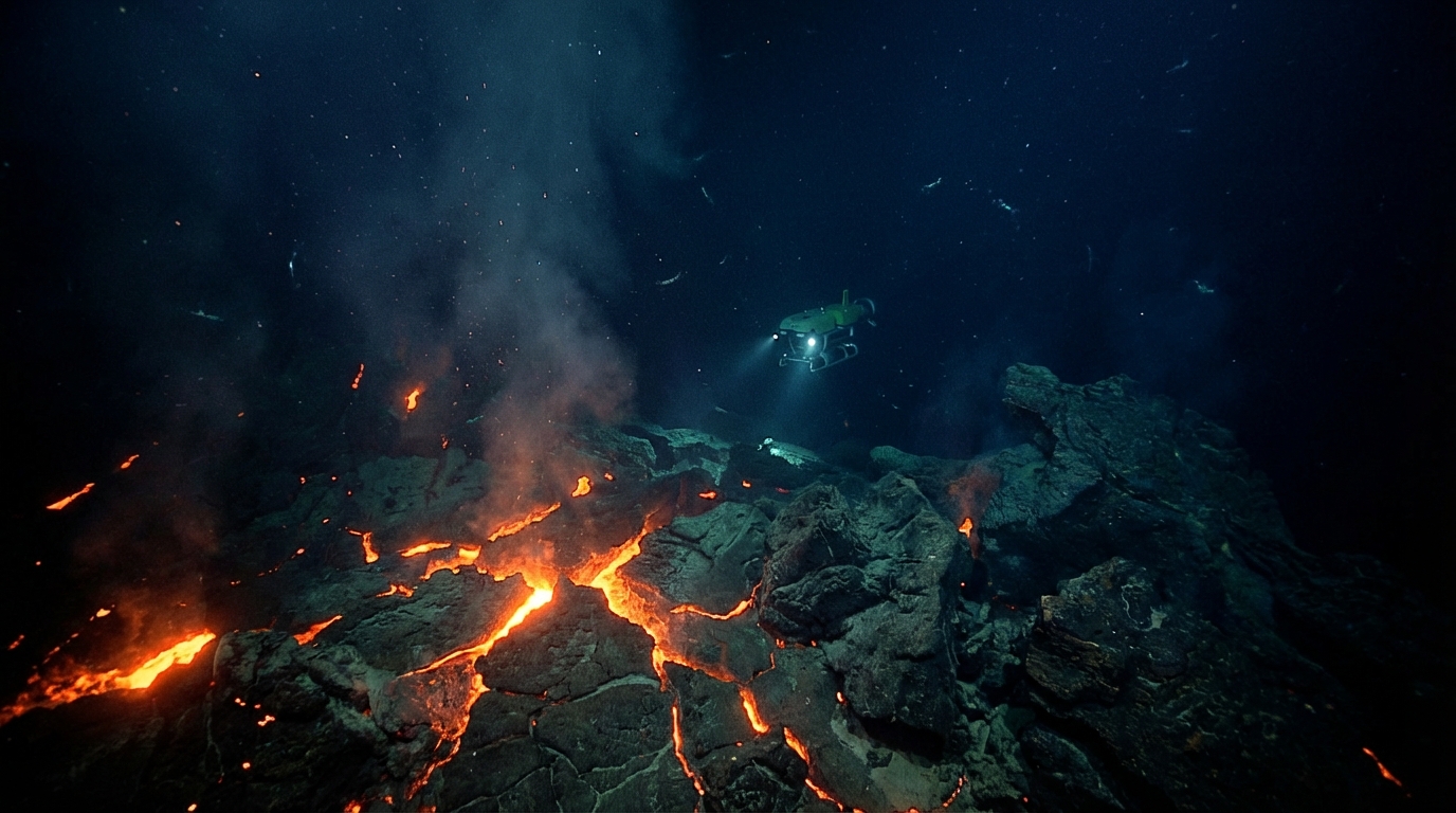
The Southwest Indian Ridge represents a divergent boundary where the African and Antarctic plates are pulling away from each other at the geological equivalent of a snail’s pace—just 14 to 18 millimeters per year. Unlike the dramatic collisions that create Himalayan-scale mountains or Japan’s volcanic arcs, this is a place of creation rather than destruction. As the plates separate, magma wells up from the mantle to fill the gap, cooling into fresh oceanic crust in a process geologists call seafloor spreading. This particular segment ranks among the planet’s ultraslow spreading centers, where the crustal production is so gradual that the ridge lacks the dramatic topography seen at faster-spreading boundaries like the East Pacific Rise. Instead, the Southwest Indian Ridge features ragged, irregular terrain with deep fracture zones and peridotite exposures—mantle rocks normally buried kilometers beneath the surface—that make it a fascinating, if remote, target for earth scientists.
Seismically, this region maintains a steady but subdued heartbeat. Unlike the earthquake-rich subduction zones that rim the Pacific, mid-ocean ridges typically generate smaller, shallower tremors as the brittle crust adjusts to the stretching and cooling of new lithosphere. The current event stands alone in recent weeks; seismic monitoring within a 200-kilometer radius detected no other significant tremors in the preceding seven days, marking this as an isolated episode rather than the opening act of a swarm. Historically, the ridge produces moderate earthquakes occasionally, though the vast majority register below magnitude 5.0, making this 4.7 event noteworthy but not unprecedented for the region.
Anatomy of a Mid-Ocean Quake
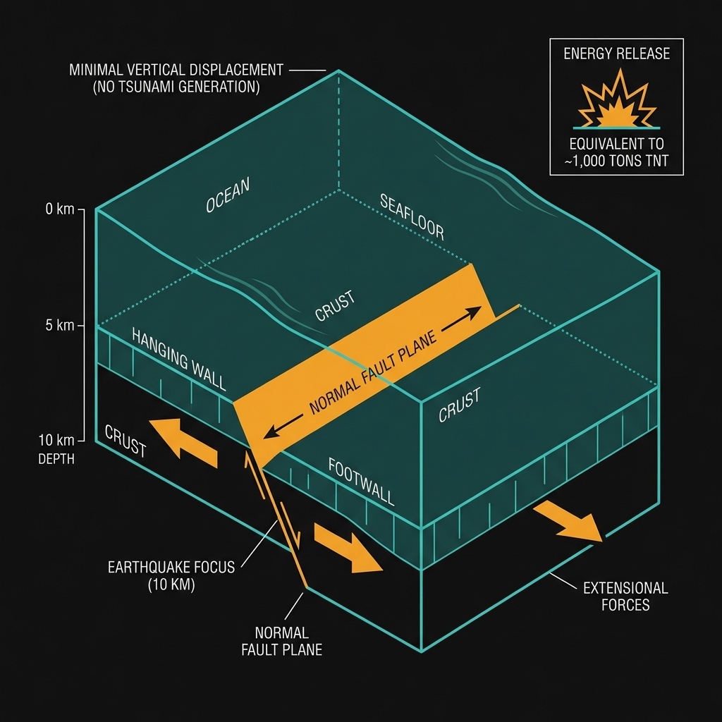
At a depth of just ten kilometers, this earthquake qualifies as shallow—even by mid-ocean ridge standards, where the brittle crust rarely extends deeper than 15 kilometers. Seismologists classify such events as normal-faulting earthquakes, a type characteristic of extensional environments where the crust is being pulled apart like taffy. In practical terms, a magnitude 4.7 release represents roughly the equivalent of 1,000 tons of TNT energy, though spread across the vastness of the open ocean, its effects remained imperceptible to human senses. No populated landmass lies within hundreds of kilometers; the nearest significant landfall would be the Prince Edward Islands or the Crozet Islands, uninhabited except for occasional research personnel. Consequently, no tsunami warning was issued—the vertical displacement required to displace a significant water column simply did not occur, and the magnitude fell well below the threshold that typically generates ocean-crossing waves.
To put the shaking in perspective, had this identical earthquake occurred beneath a populated area, residents might have experienced light trembling comparable to a heavy truck passing nearby, rattling windows and disturbing loose objects but rarely causing structural damage. The event serves as a reminder that earthquake magnitude tells only part of the story; the true measure of hazard lies in the intersection of energy release and human exposure. Here, in the vast blue wilderness between continents, the planet flexed its geological muscles with virtually no audience.
The Bigger Picture
For GeoShake and the global seismic networks that constantly listen to Earth’s vibrations, such remote events provide valuable calibration data. Each rupture along the Southwest Indian Ridge offers seismologists another pixel in the mapping of how ultraslow spreading centers behave, helping refine models of crustal accretion and heat flow from the mantle. While no aftershock sequence is currently evident—consistent with the region’s typical isolated seismicity—researchers will continue monitoring for any smaller companion quakes that might follow. In the end, this 4.7 magnitude reminder from the deep underscores a humbling truth: whether witnessed by cameras or occurring in absolute isolation, the machinery of plate tectonics operates with indifferent precision, continuously reshaping the seafloor that covers two-thirds of our planet.
Track this event live on the map!
Download GeoShake and get instant earthquake alerts.
Download GeoShake