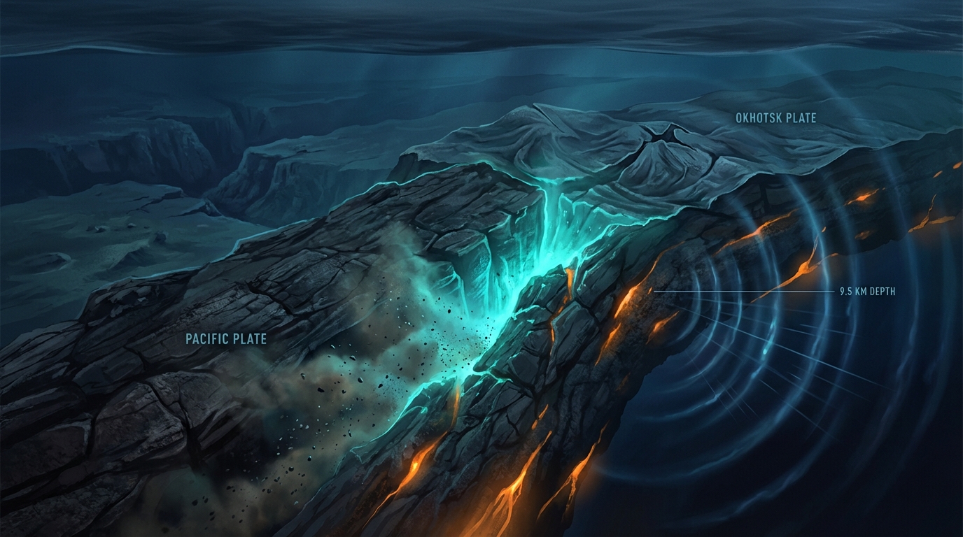
At just 9.5 kilometers beneath the ocean floor, the earth ruptured with a violence rarely felt so close to the surface. On March 26, 2026, a magnitude 6.5 earthquake struck approximately 122 kilometers east of Yamada, Japan, sending seismic waves racing toward the coast of Aomori Prefecture with minimal attenuation from depth, according to USGS data. The event, which occurred at 14:18 UTC, represents a significant release of tectonic stress in a region still adjusting to the catastrophic movements of the past.
Why Is This Region So Seismically Active?
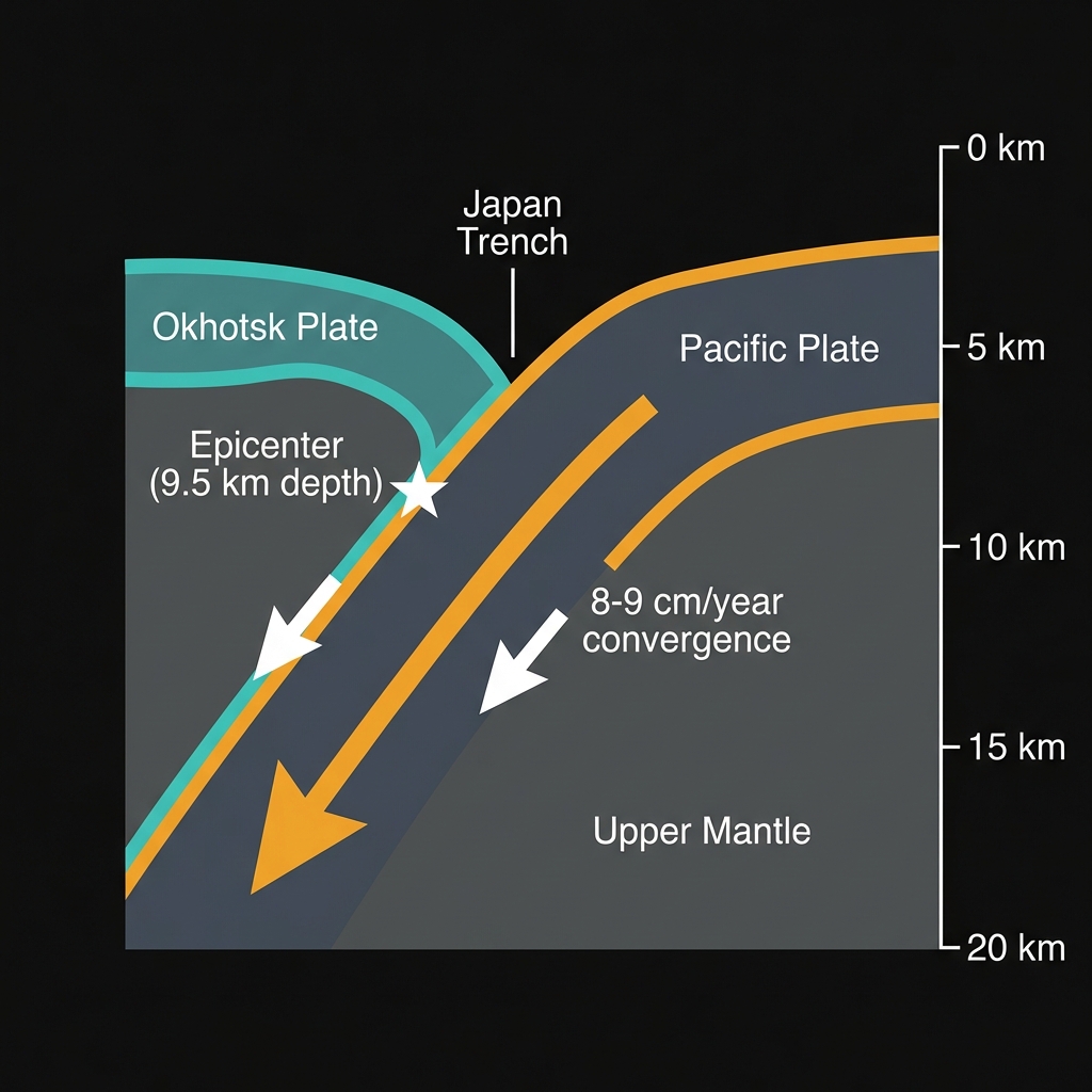
This stretch of the Pacific Ocean floor sits directly above the Japan Trench, a subduction zone where the massive Pacific Plate grinds beneath the Okhotsk Plate at roughly eight to nine centimeters per year. The process creates immense friction as the denser oceanic slab dives into the mantle, storing elastic energy that periodically releases as earthquakes. Seismologists recognize this boundary as one of the most hazardous on Earth, responsible for the magnitude 9.1 Great Tohoku Earthquake in 2011 that devastated northeastern Japan from a rupture just 154 kilometers from today’s epicenter.
Recent weeks have seen increased restlessness here. Over the past seven days, instruments recorded three earthquakes in this immediate vicinity, with today’s M6.5 representing the largest of the sequence. This clustering suggests the crust is currently readjusting to stress changes, possibly related to the massive magnitude 7.6 earthquake that struck Aomori Prefecture in 2025, located approximately 200 kilometers from today’s epicenter. When viewed alongside historical giants like the 1994 M7.8 event and the 1989 M7.4 quake near Miyako, today’s tremor fits a pattern of persistent, large-scale deformation along this convergent boundary.
| Event | Magnitude | Distance from Today’s Epicenter | Year |
|---|---|---|---|
| Today’s Earthquake | 6.5 | — | 2026 |
| Great Tohoku Earthquake | 9.1 | 154 km | 2011 |
| Aomori Prefecture Earthquake | 7.6 | 200 km | 2025 |
| Off Honshu Coast | 7.8 | 120 km | 1994 |
| Miyako Earthquake | 7.4 | 68 km | 1989 |
How Intense Was the Shaking?
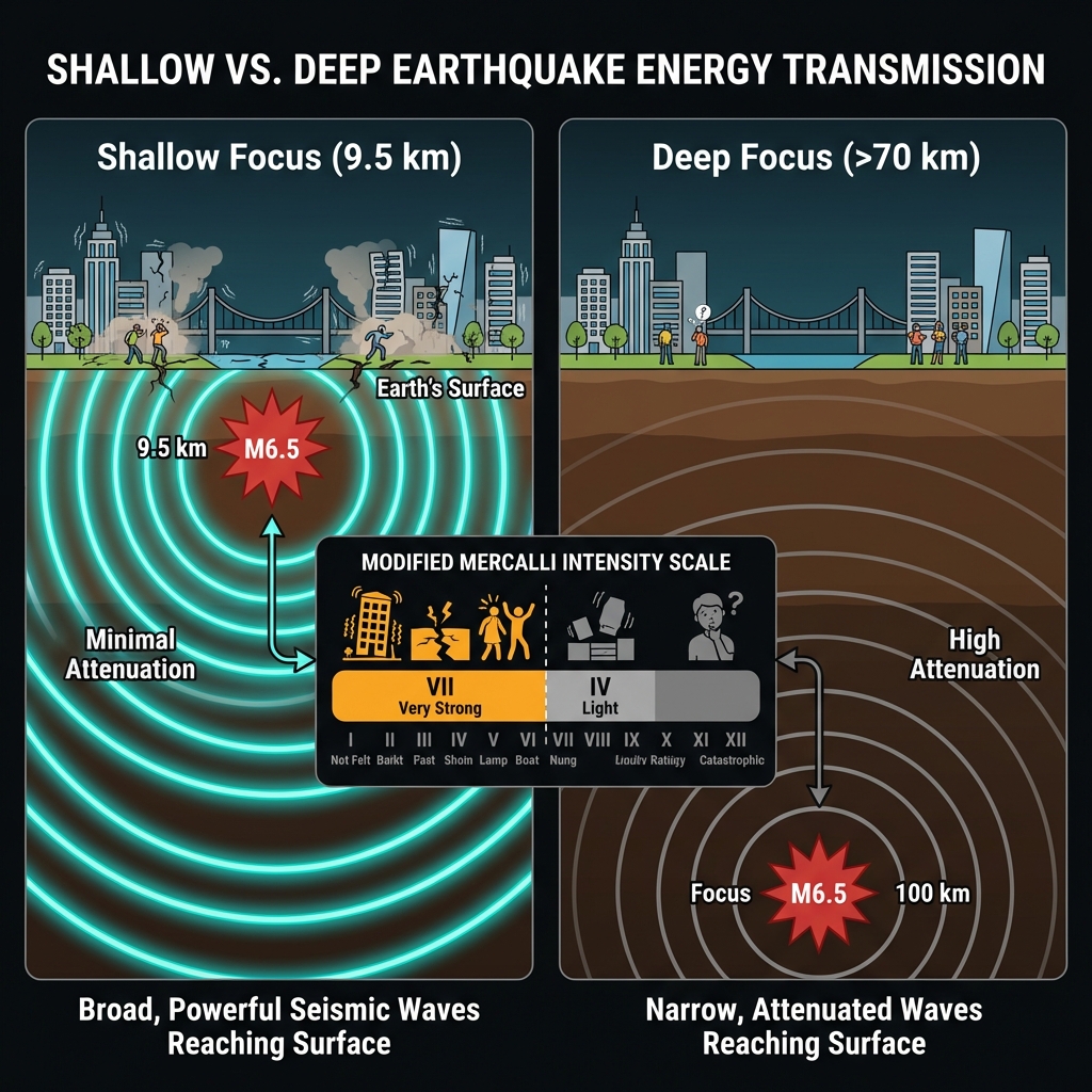
The shallow depth of 9.513 kilometers makes this earthquake particularly significant for surface shaking intensity. Seismologists classify quakes less than 70 kilometers deep as “shallow-focus,” but those occurring within the upper 10 kilometers deliver energy to the surface with brutal efficiency, much like an explosion detonating just below ground rather than deep within bedrock. At magnitude 6.5, this event packed roughly the energy equivalent of several hundred thousand tons of TNT, though the 122-kilometer offshore distance provided some natural buffering for coastal communities.
Residents of Yamada and surrounding areas likely experienced light to moderate shaking—perhaps rattling dishes and swaying hanging plants—while the seafloor above the epicenter would have convulsed with severe intensity. Seismologists classify this as a shallow-focus thrust event typical of subduction interfaces, where the rupture of locked fault planes can generate destructive ground motion. The Modified Mercalli Intensity scale suggests that had this rupture occurred beneath land rather than ocean, buildings near the epicenter could have suffered partial structural failure.
Given that this event represents the culmination of a three-earthquake cluster over the past week, residents should treat any additional tremors as potential aftershocks and avoid entering damaged structures. Inspect homes immediately for new cracks in drywall, misaligned door frames, or gas odors, particularly in older wooden structures common in rural Aomori communities. Keep mobile devices charged and emergency bags accessible near exits, as shallow crustal aftershocks above magnitude 5.0 could produce stronger localized shaking than today’s mainshock if they occur closer to shore.
What Should We Watch For Now?
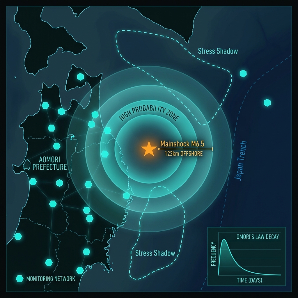
The coming weeks will reveal whether this M6.5 event represents the mainshock of the current sequence or a precursor to larger movement. GeoShake monitoring networks will track subtle deformation patterns and aftershock distributions, looking for “stress shadows” or increased seismicity that might indicate continued destabilization of the plate interface. Historical patterns from the 2011 Tohoku sequence remind us that large subduction earthquakes sometimes produce significant foreshocks months before the main rupture, making continued vigilance essential along this coastline.
Frequently Asked Questions
How strong was this earthquake?
The earthquake registered magnitude 6.5 on the moment magnitude scale with a depth of 9.5 kilometers, classifying it as a shallow, significant event. While the offshore location reduced its impact on land, such a shallow rupture would have produced severe shaking directly above the epicenter, potentially reaching Modified Mercalli Intensity VII (Very Strong) on the seafloor.
Is there a tsunami risk?
No tsunami warning was issued for this event according to available data, likely because the rupture mechanism did not produce significant vertical seafloor displacement or because the energy dissipated before reaching shore. However, residents should remain alert for several hours after any shallow offshore earthquake, as underwater landslides triggered by strong shaking can occasionally generate local tsunami waves.
Why does this region experience so many large earthquakes?
This area sits at the Japan Trench, where the Pacific Plate subducts beneath the Okhotsk Plate at a rate of approximately 8-9 centimeters annually. This convergence creates the Pacific Ring of Fire’s most active subduction zone, having produced thirteen magnitude 7.0+ earthquakes within 200 kilometers of today’s epicenter over the past four decades, including the devastating 2011 M9.1 Tohoku earthquake.
Track this event live on the map!
Download GeoShake and get instant earthquake alerts.
Download GeoShake