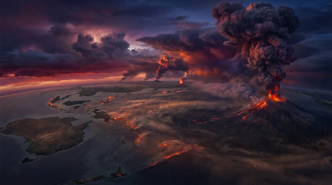
Volcanic activity intensified across the Pacific Ring of Fire and Andean volcanic belt during the past 24 hours, with monitoring networks recording 23 distinct volcanic events globally. According to the Smithsonian Global Volcanism Program and regional Volcanic Ash Advisory Centers (VAACs), the period from April 15-16, 2026, was characterized by sustained ash emissions from five major volcanic systems, with plume heights exceeding aviation safety thresholds. The most significant activity originated from Sabancaya in Peru and Sangay in Ecuador, both generating ash columns surpassing 6,000 meters above sea level.
Which Volcanoes Generated Ash Advisories Today?
Sabancaya (Peru) maintained its pattern of persistent explosive activity, producing an ash column reaching 6,700 meters (approximately 22,000 feet) above sea level according to the Buenos Aires VAAC. The Volcano Observatory of the Geophysical Institute of Peru (IGP) reported continuous emissions driven by magmatic gas thrust, with ash dispersal vectors tracking southeastward toward the Andean highlands. This stratovolcano, located approximately 70 kilometers northwest of Arequipa, remains one of South America’s most active volcanic systems, with ongoing eruptive sequences that began in 2016.
Sangay (Ecuador) generated significant volcanic ash emissions reaching 6,400 meters above crater level, as reported by the Ecuadorian Geophysical Institute (IG-EPN). The ash plume extended approximately 35 kilometers southwest of the summit, affecting remote regions of Morona-Santiago province. Sangay’s steep-sided cone structure facilitates frequent pyroclastic density currents alongside ash emissions, with the current eruptive phase representing continuous activity characteristic of this highly active stratovolcano in the Cordillera Real.
Semeru (Indonesia) produced explosive eruptions sending ash clouds to 4,600 meters (15,100 feet) altitude, according to the Darwin VAAC and Indonesia’s Center for Volcanology and Geological Hazard Mitigation (PVMBG). The eruption generated a distinct umbrella-shaped ash cloud visible on satellite imagery, drifting westward from the summit crater. Semeru, the highest volcano on Java at 3,676 meters elevation, maintains Alert Level III (Siaga), with residents advised to maintain a 5-kilometer exclusion radius from the active Jonggring Saloko crater.
Dukono (Indonesia) continued its decade-long eruptive sequence with ash emissions reaching 3,700 meters above sea level. Located on Halmahera Island in the Moluccas archipelago, this remote stratovolcano produces continuous low-level ash plumes driven by degassing of its crater lake system. PVMBG monitoring indicates the volcano maintains elevated seismicity levels, with explosion events occurring at intervals of 30-60 minutes throughout the reporting period.
How Dangerous Are Today’s Ash Emissions?
Volcanic ash generated by today’s explosive events poses multifaceted hazards extending beyond immediate eruption zones. The ash columns reported by the Smithsonian Global Volcanism Program contain fine-grained silicate particles measuring less than 2 millimeters in diameter, capable of infiltrating respiratory systems and mechanical ventilation infrastructure. At the reported heights of 3,700 to 6,700 meters, these plumes intersect commercial aviation flight levels, creating engine failure risks through melted glass coating turbine blades.
For local populations, ashfall accumulation of even a few millimeters can compromise water catchment systems, damage agricultural crops through acidification, and trigger roof collapses when saturated with rainfall. The sulfur dioxide (SO₂) flux accompanying these emissions, particularly from Sabancaya’s magmatic degassing, may generate acid rain downwind of the eruption columns. Current dispersal models indicate minimal population impact for remote volcanoes like Dukono and Sangay, though communities within 20 kilometers of Semeru remain at elevated risk for respiratory irritation and ashfall accumulation.
What Should Aviation Operators Know?
Regional Volcanic Ash Advisory Centers issued multiple SIGMETs (Significant Meteorological Information) for airspace over Peru, Ecuador, and Indonesia during the 24-hour reporting period. The Washington VAAC coordinated with Buenos Aires regarding Sabancaya’s 6,700-meter plume, while Darwin VAAC managed concurrent advisories for both Semeru and Dukono affecting air routes between Australia and Southeast Asia. Pilots should note that ash clouds at these altitudes may not be visible on standard weather radar systems, requiring reliance on satellite-based volcanic cloud detection.
Flight path modifications are recommended for corridors passing within 100 nautical miles of active vents, as volcanic ash can disperse laterally beyond visible plume boundaries. The International Air Transport Association (IATA) volcanic ash contingency procedures recommend avoiding areas with reported ash concentrations exceeding 4 micrograms per cubic meter. Current trajectory models suggest ash from Sangay may affect overflight routes between Quito and Lima, while Semeru’s emissions could impact trans-Java aviation corridors connecting Jakarta and Denpasar.
Which Other Volcanoes Show Elevated Activity?
Beyond the ash advisory events, several volcanic systems maintained elevated unrest levels according to USGS and local monitoring agency reports. Fuego (Guatemala) produced Strombolian explosions with incandescent ejecta reaching 300 meters above the crater, accompanied by lava flows in the Ceniza drainage. Mayon (Philippines) continued effusive lava dome growth within the summit crater, generating periodic rockfall events and degassing plumes reaching 1,000 meters altitude.
Marapi (Indonesia) exhibited increased seismicity with 52 volcano-tectonic earthquakes recorded by PVMBG broadband stations, though no surface eruptive activity was confirmed. Ibu (Halmahera) maintained lava dome extrusion rates of approximately 1.5 cubic meters per second, generating constant degassing and occasional pyroclastic avalanches. Lewotobi (Flores, Indonesia) produced discrete explosion events with ash plumes to 2,500 meters, while Canlaon (Philippines) and Dempo (Sumatra) showed elevated volcanic earthquake swarms indicating potential magma intrusion at depth.
Summary of Active Volcanoes
| Volcano | Location | Event Type | Alert Level |
|---|---|---|---|
| Sabancaya | Peru | Ash Emission (6,700m) | Orange |
| Sangay | Ecuador | Ash Emission (6,400m) | Orange |
| Semeru | Indonesia | Explosive Eruption (4,600m) | Orange |
| Dukono | Indonesia | Continuous Ash (3,700m) | Yellow |
| Fuego | Guatemala | Strombolian Explosions | Orange |
| Mayon | Philippines | Lava Dome Growth | Orange |
| Ibu | Indonesia | Lava Effusion | Orange |
| Lewotobi | Indonesia | Vulcanian Explosions | Orange |
| Marapi | Indonesia | Seismic Swarm | Yellow |
| Canlaon | Philippines | Volcanic Unrest | Yellow |
| Dempo | Indonesia | Seismic Activity | Yellow |
Frequently Asked Questions
What is the difference between an ash advisory and an eruption warning?
An ash advisory specifically addresses aviation hazards from volcanic ash clouds in the atmosphere, issued by VAACs when plumes exceed safe flight thresholds regardless of eruption intensity. An eruption warning or alert level change indicates increasing volcanic unrest or eruptive activity detected by seismic networks, ground deformation, or gas monitoring, typically issued by local geological surveys to warn nearby populations of potential hazards.
How long do volcanic ash clouds remain hazardous for aircraft?
Volcanic ash clouds can remain hazardous for aviation for days to weeks depending on eruption duration, atmospheric wind patterns, and particle size distribution. Fine ash particles (less than 63 microns) may remain suspended in the atmosphere for weeks, circling the globe if injected into the stratosphere, while coarse ash settles within hours. Pilots should avoid documented ash cloud areas for at least 24 hours after the last reported emission, as dispersed ash remains abrasive to engines and airframes.
Are local communities at risk from today’s volcanic activity?
Communities within 10 kilometers of Semeru face elevated risks from pyroclastic flows and lahars due to the volcano’s history of sudden explosions and steep topography. For Sabancaya and Sangay, prevailing wind patterns carry ash away from major population centers, though agricultural communities downwind may experience crop damage and respiratory irritation. Remote volcanoes like Dukono pose minimal direct risk to human populations due to their isolation, though ashfall could affect isolated villages on Halmahera Island depending on wind direction changes.
Track this event live on the map!
Download GeoShake and get instant earthquake alerts.
Download GeoShake