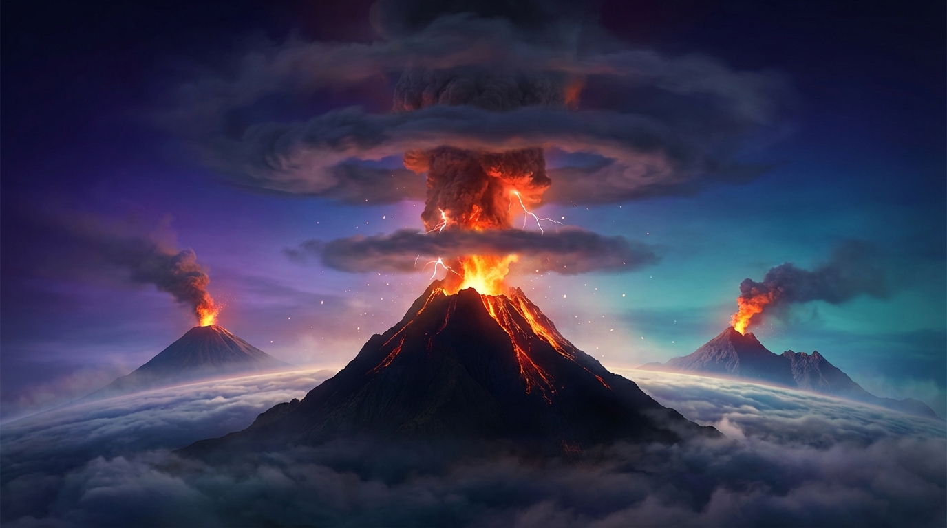
Volcanic unrest intensified across the Pacific Ring of Fire and Central America during the past 24 hours, with monitoring networks detecting 17 distinct eruptive events from eight active volcanoes. According to the Smithsonian Global Volcanism Program, ash advisories dominated the landscape as major stratovolcanoes generated plumes reaching altitudes between 4,300 and 6,200 meters. The activity stretched from Guatemala’s volatile Fuego volcano to Indonesia’s Semeru, creating significant aviation hazards and raising concerns about regional air quality.
Which Volcanoes Erupted Today?
Sangay in Ecuador produced the most significant ash emission of the reporting period, generating a plume that reached 6,200 meters (20,341 feet) above sea level on April 4. This stratovolcano, located within the Eastern Cordillera of the Andes approximately 40 kilometers southwest of Baños, has maintained continuous eruptive activity since 2019. The 6,200-meter column represents a substantial vertical hazard, penetrating the lower flight levels used by commercial aviation during approach and departure phases near Quito’s international airport.
Reventador, another Ecuadorian stratovolcano situated in the eastern Amazonian foothills, emitted an ash cloud reaching 4,600 meters (15,092 feet) according to reports from the Smithsonian Global Volcanism Program. Located roughly 90 kilometers east of Quito, Reventador’s frequent explosions often produce pyroclastic flows alongside ash emissions. The volcano’s remote location minimizes immediate human exposure, though ash dispersal patterns can affect agricultural communities downwind.
Semeru on the Indonesian island of Java generated an ash advisory with plumes reaching 4,600 meters (15,092 feet) on April 4. Indonesia’s highest volcano at 3,676 meters elevation, Semeru typically produces Vulcanian explosions every 20-90 minutes during active phases, ejecting ash and volcanic bombs from its Jonggring Saloko crater. The 4,600-meter plume height places ash directly into air traffic corridors serving Surabaya and Bali, requiring immediate coordination with the Darwin Volcanic Ash Advisory Centre.
Fuego in Guatemala entered the reporting period with renewed ash emissions reaching 4,300 meters (14,108 feet) early on April 5. Located approximately 40 kilometers southwest of Guatemala City, Fuego ranks among the world’s most active stratovolcanoes, typically generating strombolian explosions several times hourly during heightened activity states. The 4,300-meter plume represents a moderate eruption for this volcano, which is capable of producing paroxysmal events exceeding 10,000 meters during major explosive episodes.
Additionally, monitoring agencies reported persistent thermal anomalies and gas emissions from Dukono and Ibu in Indonesia’s North Maluku province, Mayon in the Philippines’ Albay Province, and Sabancaya in southern Peru. These volcanoes maintained elevated alert statuses without generating discrete ash advisories during the 24-hour window.
How Dangerous Are the Ash Emissions?
Volcanic ash presents multifaceted hazards that extend far beyond the immediate eruption column, with particle sizes ranging from microscopic glass shards to lapilli fragments capable of structural damage. The reported plume altitudes of 4,300-6,200 meters place these emissions squarely within the operational envelope of turboprop aircraft and lower-altitude jet routes, particularly during takeoff and landing procedures. When ingested by jet engines, volcanic ash melts at operating temperatures and fuses into glass coatings on turbine blades, potentially causing immediate engine failure or gradual performance degradation.
Ground-based hazards prove equally significant for communities beneath dispersal patterns. Ashfall accumulation of just a few millimeters can collapse roofs, contaminate water supplies, and devastate agricultural crops through both physical burial and chemical toxicity. Respiratory irritation presents immediate health concerns, as volcanic glass particles lodge deep within lung tissue, potentially triggering silicosis with chronic exposure. The 6,200-meter Sangay plume likely dispersed fine ash northeastward toward the Ecuadorian Amazon, while Fuego’s lower-altitude emissions typically track toward the Pacific Ocean or Guatemala’s western highlands depending on seasonal wind patterns.
What Should Aviation Know?
Pilots and flight dispatchers should monitor advisories from the Washington, Darwin, and Buenos Aires Volcanic Ash Advisory Centres (VAACs), which issued guidance for the reported plumes between April 4 and April 5. While specific aviation color codes were not disclosed in the initial Smithsonian Global Volcanism Program reports, the issuance of ash advisories indicates that concentrations exceeded thresholds safe for aircraft operations. Flight levels between FL140 and FL200 (approximately 4,300-6,100 meters) face the greatest immediate risk, though ash can disperse horizontally over hundreds of kilometers at these altitudes.
Aircraft encountering volcanic ash may experience multiple system failures simultaneously, including engine flameout, pitot tube blockages causing erroneous airspeed readings, and windshield abrasion reducing visibility to zero. The International Civil Aviation Organization recommends avoiding ash-contaminated airspace entirely rather than attempting penetration, as ash clouds often appear visually similar to meteorological weather formations on radar. Operators should expect rerouting delays for trans-Andean and intra-Southeast Asian routes until dispersal models confirm clearance.
Are Local Communities at Risk?
While no immediate evacuation orders were reported by local monitoring agencies during this 24-hour period, residents near these volcanoes should maintain preparedness for rapid alert level changes. Fuego’s pattern of paroxysmal explosions historically necessitates evacuations of communities on its southern and western flanks when pyroclastic flow generation becomes likely. Sangay’s remote location within Sangay National Park reduces direct population exposure, though lahars (volcanic mudflows) triggered by ash-mobilized rainfall pose downstream threats to Amazonian villages.
Agricultural communities should implement protective measures for livestock and crops, as even minor ashfall can render pasture toxic and clog irrigation systems. Water treatment facilities near Semeru require particular vigilance, as ash-laden runoff into the Besuk Kobokan drainage system can overwhelm filtration capacity. Residents are advised to maintain emergency supply kits including N95 respirators, goggles, and sufficient bottled water for 72 hours of isolation.
Active Volcano Summary Table
| Volcano | Location | Event Type | Alert Level |
|---|---|---|---|
| Sangay | Ecuador | Ash Advisory (6,200m) | Not Specified |
| Reventador | Ecuador | Ash Advisory (4,600m) | Not Specified |
| Semeru | Indonesia | Ash Advisory (4,600m) | Not Specified |
| Fuego | Guatemala | Ash Advisory (4,300m) | Not Specified |
| Dukono | Indonesia | Persistent Activity | Not Specified |
| Ibu | Indonesia | Persistent Activity | Not Specified |
| Mayon | Philippines | Persistent Activity | Not Specified |
| Sabancaya | Peru | Persistent Activity | Not Specified |
Frequently Asked Questions
How does volcanic ash damage aircraft engines?
Volcanic ash particles have a melting point lower than the operating temperatures of jet turbine engines, causing them to melt and adhere to rotating components as a glassy coating. This process alters aerodynamic profiles, blocks fuel nozzles, and can cause engine flameout within minutes of ingestion, requiring immediate shutdown and restart procedures that may fail at altitude.
What protective measures should residents take during ashfall?
Individuals should remain indoors with windows and doors sealed using damp towels, wear N95-certified masks when outdoor exposure is unavoidable, and avoid driving to prevent vehicle engine damage and road accidents caused by reduced visibility. After ashfall ceases, residents should clear roofs and gutters carefully to prevent structural collapse from accumulated weight, using respiratory protection and minimizing dust generation.
How frequently do these volcanoes typically erupt?
Fuego and Sangay represent two of the world’s most persistently active volcanoes, with Fuego producing near-continuous strombolian activity punctuated by major paroxysmal episodes several times annually, and Sangay maintaining ongoing lava effusion and explosive activity since 2019. Semeru generates Vulcanian explosions at intervals of 30-90 minutes during active phases, while Reventador produces daily ash emissions interspersed with periodic dome collapses, making the current activity consistent with long-term patterns documented by the Smithsonian Global Volcanism Program.
Track this event live on the map!
Download GeoShake and get instant earthquake alerts.
Download GeoShake